Did you catch Dr. Catherine Nakalembe’s incredible talk at EduDrone 2020 about drones in Uganda? She shared with us the role that drones and STEM geography can play in assisting refugee settlements.
Missed it? Don’t stress! Each month in the lead up to EduDrone 2021, we’ll be releasing one of our favourite talks from EduDrone 2020! Tune in each month to get your fix of STEM-spiration. We hope this will keep the ideas flowing all the way through until EduDrone 2021!
As an Assistant Research Professor at the University of Maryland, Dr. Nakalembe’s work primarily focuses on monitoring agriculture using remote sensing. It was this research interest that introduced her to advanced drone programs for schools, and she first used drones as part of a project to monitor crop land in Uganda and Tanzania.
Through her work monitoring agricultural crops in Uganda, Catherine became involved with the United Nations Development Program (UNDP), who were interested in climate resilience, disaster risk reduction, and supporting programs for development in refugee settlements in Uganda. It was during this project that something clicked for Catherine. She realised that not only could drones be used for monitoring agriculture, but also to survey and plan major refugee settlements in Uganda.
This week the 20th June celebrates World Refugee Day, which honours the strength and courage of refugees and encourages public awareness and support of people who have had to flee their homelands because of conflict or natural disaster.
Uganda, a relatively small, land-locked country in East Africa, supports about 1.4 million refugees – which is the fourth highest refugee population in the world. Despite the huge number of refugees they support, Uganda has also been ranked as one of the best places in the world to be a refugee. This is because the government and agencies do an incredible job of ensuring that when refugees come to the country, they have the basis for a good livelihood and recovery. Refugees are integrated into communities, and have the same access to education and land for agriculture as Ugandan citizens.
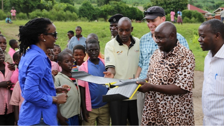
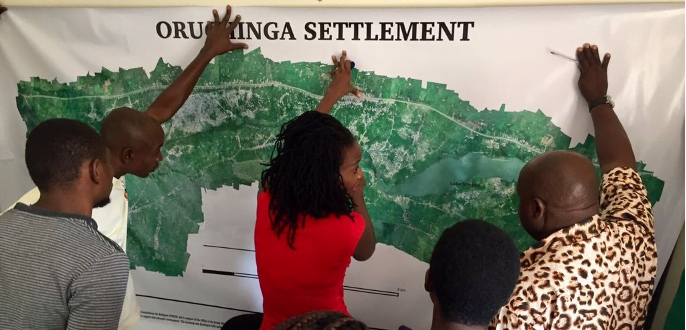
Once Dr. Catherine Nakalembe had her lightbulb moment about using drones to survey refugee settlements, she set out to trial this in the Oruchinga settlement in the south west of Uganda. The Oruchinga settlement has been there is the 1960s, and Catherine was excited for this work as she knew she would be mapping things that were really important to people.
There is a lot of planning that goes in to establishing a refugee settlement, and many challenges faced when it comes to managing such a large number of people. By using drones to capture aerial images of the settlement, Catherine is able to turn those into an orthomosaic, print out maps, and provide an invaluable resource for the local people to visualise and plan their own communities. Using these orthomosaics, you can also determine how far away people are from key infrastructure such as health centres, water facilities, and schools – which helps governments and agencies in future planning.
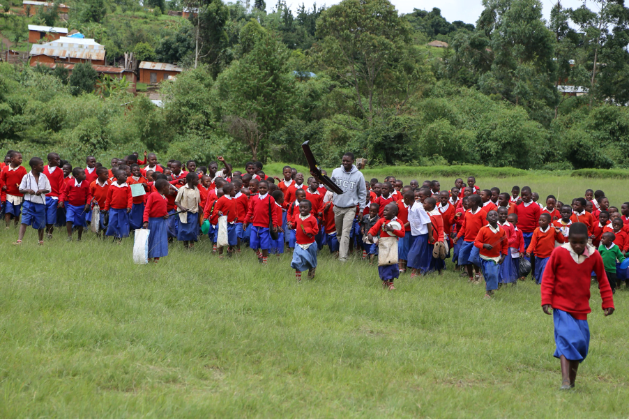
Catherine said that one of the best things about this project was being able to take the information back to the refugee community and have discussions with them. Through these meetings, she was able to determine that although flooding is generally not an issue, communities can get cut off when there are extensive rain days. They are unable to cross the river and therefore get to the health centre during the rainy season. As climate change will increase the frequency of these extreme weather events, it’s important that future planning within the Oruchinga settlement address this issue. And by having STEM education for secondary schools, the younger generation will be able to help the older generation build a more climate resilient community.
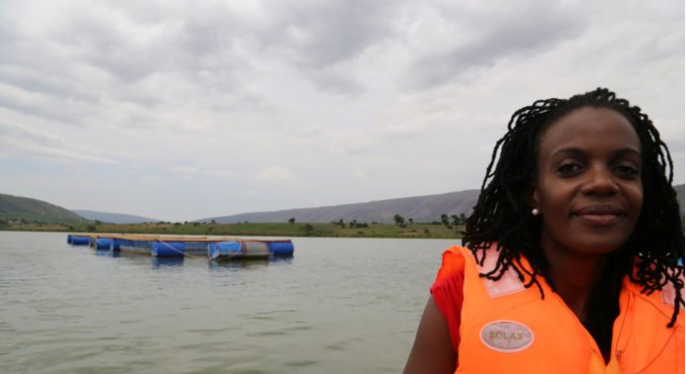
In Uganda, a lot of changes happen when people settle in an area, including sand mining, fish farming, and deforestation for agriculture. Using these maps, Catherine is able to show the communities the changes that are taking place cumulatively.
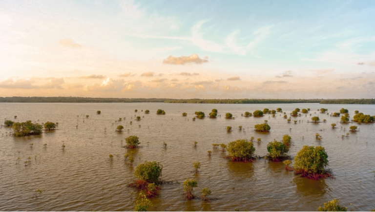
In Oruchinga, she was able to demonstrate that over 50% of the area had been impacted by sand mining, and it had caused the lake to expand, which may impact flooding in the area later on. It’s easy to see all of these changes when they are laid out in an orthomosaic map, and promotes more sustainable land use in the long term.
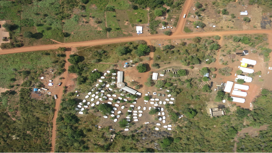
In beginning of July 2016, there was a huge influx of over 22,000 refugees who arrived in Uganda due to an outbreak of violence in Sudan. Can you even imagine trying to manage that many people – all of whom had experienced significant trauma and upheaval, and were arriving with little to no possessions? Despite the chaos, the United Nations announced that it was the fastest they had ever seen that many refugees settle in an area. Uganda established the Bidibidi settlement to house these refugees, and for a while it was the largest refugee settlement in the world.
Catherine was in Uganda doing field work at the time, so she offered to assist in mapping the refugee settlement. The Ugandan authorities had to work out how to settle so many refugees so quickly, and how to ensure they had access to the many different things that they needed. By using mapping in settlement planning you could easily assess whether people had adequate access to shelter, water points, and early childhood development centres.
Dr. Nakalembe ensures that her research is always going back to the local community, and engages locals to gather data as much as possible. She works with local university students and representatives from local government as interns during her field work. Her partners in Tanzania have recently adopted geospatial science for schools and purchased their own drone. These initiatives allowed them to start mapping some of their refugee settlements.
Make sure you check out Dr. Catherine Nakalembe’s full EduDrone 2020 presentation below! And you can download her presentation slides here as well.
Read here to discover other meaningful uses of drones and digital technology in agriculture.
She Maps is Australia’s leading expert in drone and geospatial education.
She Maps assist schools with the purchasing of drones, school-industry created drone and geospatial teaching resources and highly supportive teacher professional development.
Ready to buy drones for your school? We are an authorised DJI reseller in Australia

Subscribe by email and never miss a blog post or announcement.
She Maps aims to bring much needed diversity and support to STEM. We do this by providing drone and geospatial programs to teachers and schools across the globe.
At She Maps we acknowledge the Traditional Custodians of Country throughout Australia and their connections to land, sea, and community. We pay our respect to their Elders past and present and extend that respect to all Aboriginal and Torres Strait Islander peoples today.
Aboriginal and Torres Strait Islander peoples are advised that this site may contain names, voices, or images of people who have passed away.
Learn the 6 Steps to Launching a Successful Drone and Geospatial Program at your School
Take our resources for a spin and join the thousands of teachers who love our ready-to-teach classroom materials. Try one of our complete units of work for free.