How one cadastral surveyor performed land boundary surveys of the very tip of Australia.
Many of us see surveyors working with their tripods by the roadside but have a limited understanding of what it is they do or just how different and exciting their jobs can be. We’re on a mission to showcase surveying! We’re teaming up with a number of young surveyors across the world to bring you their favourite projects and what they love the most about working as a surveyor.
Surveying is the measurement and mapping of our surroundings using mathematics, specialised technology and equipment. Surveyors measure just about anything, from buildings and structures, to the land, the sky or the ocean bed. They even measure polar icecaps!
Whilst surveyors use maths skills and technology to do their jobs, there is also a strong link to Geography. Surveyors use geographical inquiry skills on a daily basis to observe, question, and plan how to solve problems. They collect, record, and represent information and data from a variety of sources.
Once they have this information, they make interpretations and conclusions, and then communicate these results and findings to a wide variety of audiences.
This series showcasing surveyors, is designed to show students and teachers how the curriculum content can be bought alive in real-world examples.
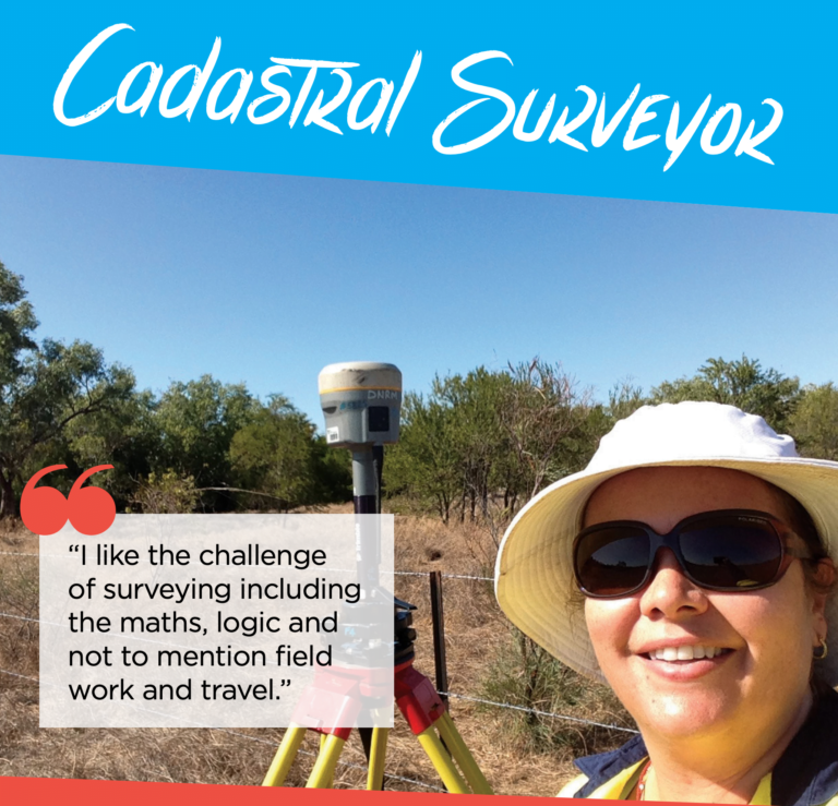
Jemma is a Cadastral Surveyor in the Queensland Government Department of Resources in Cairns, Far North Queensland. Her love of geography (people, places, maps) and mathematic skills steered her towards a career in surveying, and she now holds a Bachelor of Surveying and Bachelor of Information Technology. Jemma enjoys the challenge of surveying in its maths and logic, as well as the opportunity to do field work and travel. Her favourite project throughout her career so far has been the Cape York Peninsula Tenure Resolution Project.
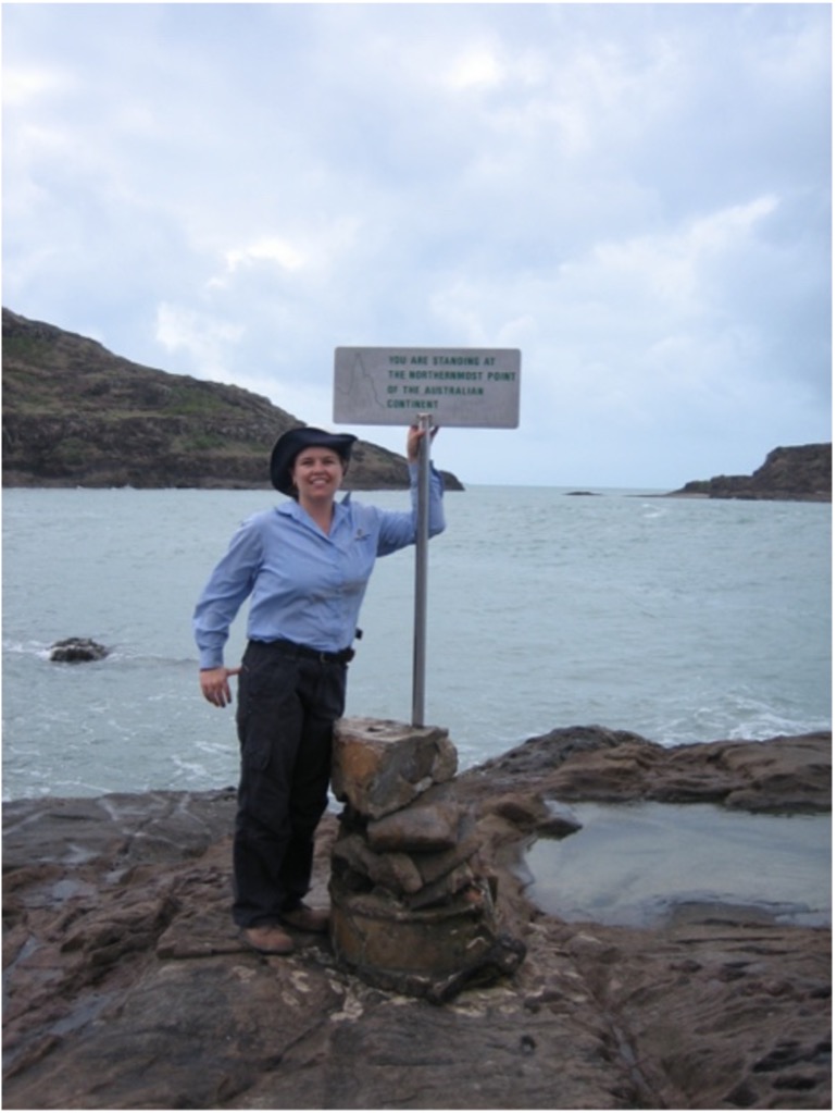
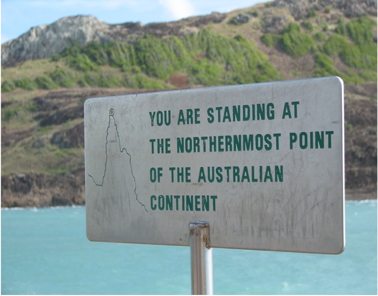
Jemma standing at the tip of the Cape York Peninsula – the northernmost point of continental Australia
On the East Coast of Australia, as far north as you can go (without a boat), you’ll find the Cape York Peninsula. Covering an area of around 220,000km2, the region is known for its remoteness, stunning natural beauty, Aboriginal cultural heritage, and for being geographically the northernmost point of continental Australia – affectionately nicknamed “the Tip”. Cape York is a very special place and is environmentally and ecologically significant to Queensland and Australia. With over 17 Indigenous communities in Cape York, the region has a rich cultural history that has survived for tens of thousands of years. Read more about Native Title here!
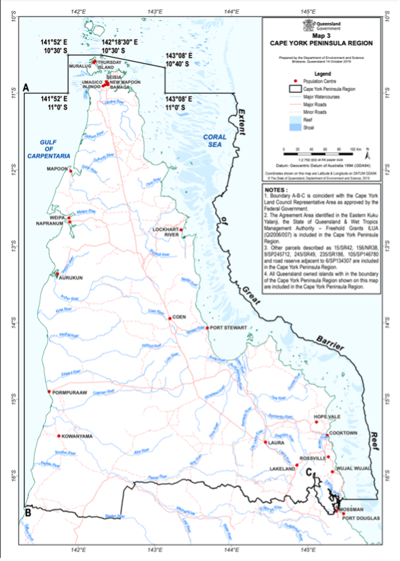
Map of Cape York
The Queensland Government’s Cape York Peninsula Tenure Resolution Program returns ownership and management of identified lands on Cape York Peninsula to local Aboriginal Traditional Owners, while ensuring the protection of Cape York Peninsula’s iconic natural areas and significant natural and cultural values.
Through this program, the state is changing the tenure of identified Cape York properties to Aboriginal freehold land, allowing Traditional Owners to return to live on country and pursue employment and business opportunities in land management, grazing and private tourism ventures. Those areas of the land which have outstanding environmental values are being dedicated as jointly managed national parks. With support from Traditional Owners, the state is also converting existing national parks, to jointly managed national parks (Cape York Peninsula Aboriginal Land) – CYPAL, with Aboriginal freehold as the underlying tenure. As of 2020, this program has transferred 3.69 million hectares of land, made up of:
Jemma and her team have been working on this ongoing project and are responsible for accurately reinstating and marking out the boundaries for individual land parcels throughout the Cape York Peninsula which form part of the program. Jemma has been integral in providing survey advice, performing surveys, producing survey plans, and maps for the Cape York Peninsula Tenure Resolution Program.
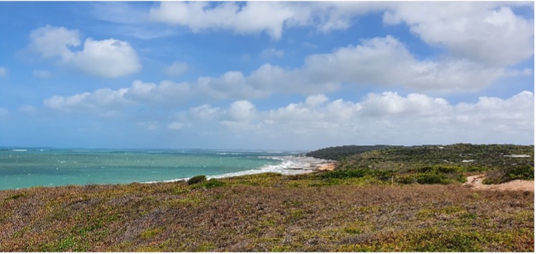
Remote wilderness on the east coast of Cape York
During this project, Jemma travelled throughout the Cape York Peninsula completing cadastral surveys. For many people Cape York is on their bucket list of places to visit but for Jemma visiting Cape York was part of her job!
Cadastral surveying is the process of accurately defining property boundaries and understanding the laws of land ownership. This may include the identification of residential or rural boundaries, re-establishing boundaries that have been previously surveyed or creating new boundaries as part of the land subdivision process.
Throughout the area of interest for the Cape York Peninsula Resolution Program, Jemma measures the dimensions of properties and road boundaries. This involves travelling to sites, searching for old survey marks, measuring bearings/angles and distances between these marks, performing mathematical calculations, and then placing new survey marks. To undertake this work, Jemma uses an instrument called a total station which measure angles and distances using Electronic Distancing Measurement (EDM). She also uses Global Navigation Satellite Systems (GNSS) which is the term for all of the satellite positioning systems including GPS, GLONASS, Galileo, and Beidou.
Based on this fieldwork and existing survey information, including old survey plans showing property boundaries, Jemma and her team produce new survey plans which allow for the creation of new titles and interests in the Titles Registry of Queensland.
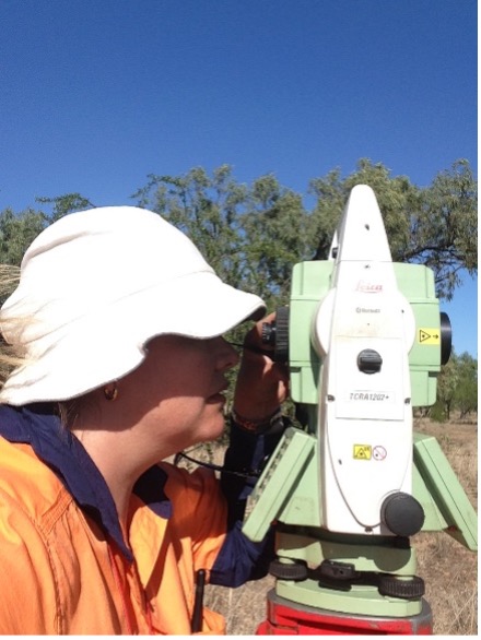
Jemma using a total station to perform land boundary surveys
Surveying is a career full of opportunities. So far in Jemma’s career she has worked with specialist surveying IT systems and Geographic Information Systems (GIS), worked in the field and now is predominantly office based leading a team of surveyors in the Queensland Government. Jemma’s role today has a focus on in providing specialist advice on land boundaries for projects such as the Cape York Peninsula Tenure Resolution Project. Jemma’s favourite part of this project is being integral to the delivery and success of the project including return lands to the traditional owners and playing a part in preserving the environment and unique wilderness of Cape York.
When asked what she would say to someone considering a career in surveying, Jemma said:
“In the STEM arena, surveying is often forgotten or overlooked. As one of the oldest professions in the world, that has changed with the times and technologies, surveying is worth looking into as a career. If you like maths and geography as well as the possibility of working both indoors and outdoors, then surveying could be for you!”
Here are some women we have already featured.