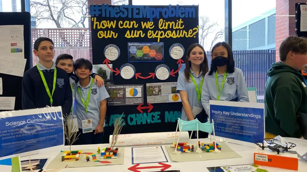
The competition is back on! As part of their annual ‘How Cool is Your School’ mapping competition, She Maps are sharing their set of curriculum-aligned mapping resources with teachers…for free! This ‘cool’ competition has been growing in popularity each year as students from across Australia take their mapping skills to the next level to measure and assess how much shade is available at their school.
Beginning in 2019, this She Maps competition has grown in popularity and reach, with many new recruits participating for the first time, alongside teachers and students returning to put their mapping skills to the test. Last year was the biggest year yet with over 1000 teacher registrations and a whopping 887 student entries from rural, regional and urban school communities.
The competition resources include an easy-to-follow set of lessons where students use satellite data from GeoNadir to map the amount of shade on their school grounds. Students will:
Create a map that meets cartographic (mapping) conventions
Calculate the percentage of shade found on their school grounds
Combine their map and data to create an infographic
Enter the infographic into the competition
Have a whole lot of fun doing it!
These lesson plans are linked to the Australian Curriculum including HASS (Geography), Technologies, Science and Mathematics, making it a cross-curricular learning experience.
The How Cool is Your School competition is great for teachers because all of the lesson planning has already been done (thanks She Maps!). It is also great for students, learning mapping skills is an important part of a student’s development and education.
Today’s students have grown up with technology. As a result of this, most of them are naturally tech-savvy. They know how to use GPS on a device to get them to places they want to go. However, mapping involves so much more than simply accessing directions, it also requires spatial thinking.
Put simply, spatial thinking is what allows us to better comprehend the world around us. It involves looking at the position and size of objects (such as buildings and trees) and seeing the way they fit into our environment. By developing their own map, students will not only be better able to make connections with their environment, they will also be able to look at ways they can improve it.
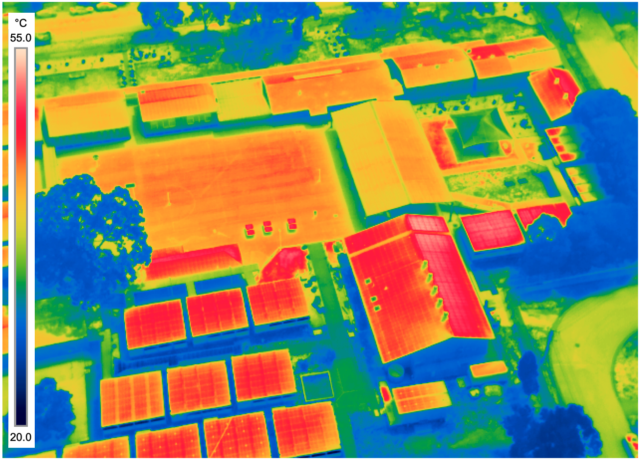
Here in Australia we are no strangers to long hot summers! Each year students are asked to investigate how ‘cool’ their school is by calculating the percentage of shade available on their school grounds. The past 4 years of this competition has revealed that the majority of participating schools have less than 15% available shade, which in our climate makes for a hot, uncomfortable learning environment (it’s no wonder there has been such a big push to have air-conditioning in every classroom).
As our climate gets hotter every year, there is more research focusing on heat and the way that it affects our bodies. The Cool Schools report tells us that heat makes it harder for students to learn. This report also indicates that heat reduces “cognitive ability under thermal stress” and offers “major health and safety hazards to children,” both of which have an adverse effect on learning.
Why is Green Shade Important?
Did you know that different types of shade provide different levels of ‘cool’? By blocking the sun’s rays, all shade will have some cooling effect. When sunlight shines on an artificial surface such as a tin roof or shading cloth, that surface will radiate heat. However, when the sun shines down on a tree, rather than radiating heat, that tree is able to absorb some of the heat from the sun, resulting in cooler temperatures (Aren’t trees awesome!). So while any type shade is good, green shade is by far the ‘coolest’ shade around.
Once students know what percentage of shade is available at your school, why stop there? Green shade plays a significant role in cooling our environment. Why not extend your students’ knowledge and challenge them to do a shade audit of their school (included in the free resources). In this audit, students will measure and record the artificial and green shade on their school grounds and investigate the impact that these shades have on the thermal comfort of their school.
By engaging in this shade audit, students are given the tools they need to think critically and sustainably about the different ways the temperature at their school could be lowered. They can use their findings to determine which areas in their school should have the highest priority for installing shade cover. We urge all teachers to empower their students to advocate for change as they consider the future thermal sustainability of their school.
If you enjoyed this article and would like to learn more or hear how other teachers have implemented the ‘How Cool is Our School’ competition into their teaching, then we highly encourage you to read the following articles:
She Maps is Australia’s leading expert in drone and geospatial education.
She Maps assist schools with the purchasing of drones, school-industry created drone and geospatial teaching resources and highly supportive teacher professional development.
FREE eBook – How to start a drone program at your school – Teachers Guide – Download Now
Learning Solutions Guide – Programs, Products and Pricing Guide – Read now
Ready to buy drones for your school? Browse our convenient classroom kits!
You’re in Safe Hands!
She Maps is a CASA approved commercial operator to fly microdrones indoors with students and teachers. CASA holds commercial operators, to a higher standard than recreational users and educators. This means that She Maps has been assessed by CASA as having rigorous training and risk mitigation procedures in place.
Want some help?
Schedule a call with one of our team members to get some personalised recommendations.
Take our resources for a spin and join the thousands of teachers who love our ready-to-teach classroom materials. Try one of our complete units of work for free.


