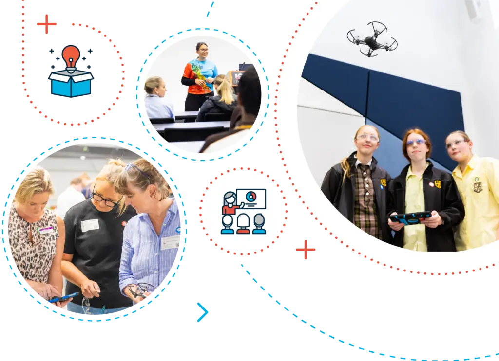
Bring Educational Drones into Your Classroom
Classroom Drone Essentials is one of our beginner drone programs for schools that gives you remarkable drone activities for students.
Classroom Drone Essentials
In this 2.5-hour edutainment experience, your students will become geospatial scientists for the day, be exposed to great role models, challenge unconscious bias, explore applications of drone technology, understand safety and drone regulations as well as learn how to fly and code educational drones. More Information
MODULE 1
Drone Equipment Preparation
Learn how to set up the tablets, drones and the learning space.
Module 2
Safety First
Understand safety and drone regulations and establish class rules.
Module 3
Real World Applications
Explore applications of drone technology in the real-world.
Module 4
Learn to Fly
Module 5
Coding for Aerial Survey

Student Outcomes
Get real hands-on experience with drones, understand real-world applications, and learn how technology can be utilised to support problem-solving. Learn how to manually control and code a drone flight path. Give every student the opportunity to develop a passion and interest in STEM education.

Teacher Outcomes
You will learn to guide your students in exploring applications of drone technology, understanding safety and drone regulations, and taking flight for the first time. Gain confidence and empower you to build competencies, knowledge and the skills to teach She Maps drone education programs in accordance with the National Curriculum.
What will work better for you, your students and your school?
Classroom Drone Essentials can be delivered face-to-face (incursion), via virtual coaching, and online professional learning, or a combination of these.

In short, NO. You don't need to know how to fly drones, but you will need to understand how to prepare the equipment (drones, iPads and apps) for the lesson. As part of our support, we will help you to master this.
Online together is a collaborative approach (or hybrid learning model) to help you to teach your students how to fly and code drones. Let's say it's roughly 50% Professional Development and 50% Online Team Teaching/Support. We team teach the Introductory Lesson (30-45 minutes), schedule three 1-to-1 Teacher Professional Learning calls (45-minute each) and provide ongoing 1-1 support, and email technical support for the duration of the Unit of Work.
Don't worry, our job is to ensure you are prepared and confident to teach this unit of work. That's why we have three 1-on-1 calls to assist with setting up the equipment, the learning space, the lesson flow and recommended best practice. We'll help you to feel confident and prepared to teach this unit of work.
One of the best things about Classroom Drone Essentials is that the unit of work can be taught in a 2.5-hour block, or you can break the lessons up into 3 separate lessons of 45 minutes each. For example Introduction & Safety (includes Unconscious Bias and diversity in STEM discussions), Manual Flying, and Coded Flying.
Teaching Classroom Drones Essentials (CDE) is just the beginning. We hope that we've captured the hearts and minds of your students and they demand you keep on planning drone flying into your planning calendar. With your She Maps Membership, you not only get CDE but you get access to some great ideas to extend the students learning including Drone Choreography, Drone Obstacle Course and Drone Baseball. Moreover, each term we release a new unit of work, in partnership with an industry partner and this includes a real-life scenario for the students to solve. You'll never be short of ideas or curriculum!
If you already have a She Maps Membership, then simply log in to access the curriculum. If you would like more support or to find out more about Classroom Drone Essential - Online Together, then book a call and he will chat through our membership and support options. More information: Brochure, Delivery Options, Website Page
TRAINING & RESOURCES
Feel confident & prepare
ACTIVITIES & LESSON PLANS
Deliver Real STEM curriculum outcomes
GET ON TOP OF STEM
Be a leader at your school

STEM PLANNING SESSION
30-minute chat with a STEM expert
She Maps can help you get the clarity you need to empower your students, engage your colleagues, and transform your schools approach to STEM.
Created by educators, for educators
Our drone days and STEM professional development programs are designed to meet your biggest STEM challenges.
Programs delivered in schools within Australia and internationally.
Students and teachers positively impacted by our drone days.
PhD
All programs designed by PhD Geospatial Scientist, Dr Karen Joyce.
For more in-depth information on Classroom Drone Essentials, or to share this information with a colleague Click Here
Discover our other STEM Programs
We believe every student deserves to succeed with STEM,
and every teacher should be empowered to help them do it.

Pippa & Dronie
Join in the adventure as Pippa and Dronie travel around Australia, finding out just how useful a drone can be! Meet real scientists and drone professionals doing amazing things.
Skill Level - Kindy to Grade 4

Map My School
A comprehensive and fun program where students learn how to analyse, measure, map, and communicate with geospatial mapping principles to better understand the amount of shade available at your school.
Skill Level - Grade 7 - 10

Drone Mapping
The students will use sub 2kg drones and industry standard geospatial
mapping technologies to capture and process imagery to analyse and
monitor their local environment.
Skill Level - Grade 10 - Industry

DroneBlocks Advanced
Extend your students learning beyond basic coding with DroneBlocks courses. Use JavaScript and Python to control your Tellos!
Skill Level - Grade 7 - 12+

Lighthouse Schools
This is She Maps' highest supported program, providing teachers and students with a tailored curriculum, focused on the development of spatial skills, using drones as the centrepiece.
Skill Level - Grade 7 - 12+
Hear what schools have said about our Drone Activities for Students.


Meet the Education Director
Dr Karen Joyce holds a PhD in Geographical Sciences and is a leader in remote sensing and spatial mapping. She has led numerous programs within Australia and internationally and developed educational resources for primary, elementary, secondary and tertiary institutions as well as private industry and government organisations.
Now, her experience is available to you.
