Bringing surveying to life in the classroom

She Maps and the Surveyors’ Trust have partnered to build a stronger talent pipeline into the surveying industry.


Maths in Surveying

A free, curriculum-aligned lesson sequence for secondary maths teachers.

Download it instantly and use it to connect classroom maths to the world of surveying and geospatial technology.

Book cover featuring maths and surveying theme

Inside you’ll find five ready-to-teach lessons mapped to the Australian Curriculum for Years 7–10:

  • Land Survey and Area Calculation — students measure and map real school grounds
  • Surveying Safe Slopes and Accessible Ramps — gradient, ratios, and disability access law
  • Mapping Bushfire Evacuation Routes — scale, bearings, and emergency planning
  • Modern vs Old-School Surveying — measurement error and percentage calculations
  • Measuring Heights and Distances — trigonometry with clinometers, outdoors

Surveying is facing a serious skills shortage

Australia’s surveying and geospatial sector is growing fast – driven by infrastructure booms, urban development, and the rise of drone technology. But the talent pipeline isn’t keeping up.

Too few young people know what surveying involves, or that it leads to rewarding, well-paid careers. We’re here to change that — by going directly into Queensland classrooms.

Woman using a surveying instrument outdoors

4 schools

in Queensland in 2026

4 programs

Full-day boot camp format

The Surveyors' Trust

The Surveyors’ Trust is a core industry body dedicated to advancing the surveying profession through education, advocacy, and direct investment in workforce development.

Industry body

The Surveyors' Trust represents the surveying profession at a national level, championing standards and long-term workforce development.

Program Funder

The Trust is funding the Surveyors in Schools program, covering bootcamp delivery across Queensland throughout 2026.

Shared Mission

Together, we're working to introduce surveying to the next generation and build a sustainable pipeline of talent.

What we're working towards together

Across a sequence of scaffolded lessons, students take part in a simulated drone surveying mission.

She Maps icons career inspiration 1

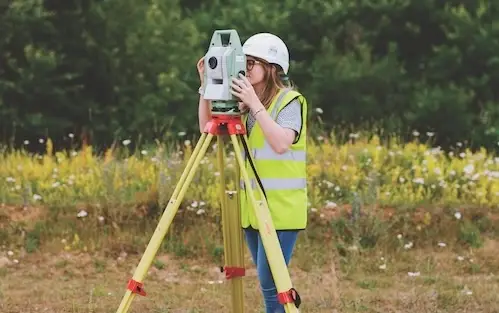
Build the talent pipeline

Get more young Australians excited and genuinely informed about careers in surveying and geospatial science.

21st century skills

Make maths relevant

Connect what students learn in the classroom to real-world applications they can see, interact with, and apply.

website icons global application 1

Connect schools to industry

Bridge the gap between the classroom and the profession through direct engagement with working surveyors.

website icons face to face 1

Support teachers year-round

Equip educators with free, curriculum-aligned resources so the learning extends well beyond a single bootcamp day.

Surveyors in Schools: Queensland 2026

A series of four full-day bootcamps across Queensland schools — designed to bring advanced maths to life through drone technology and direct engagement with surveying professionals.

Each bootcamp is hosted at a Queensland school, spread across three terms throughout 2026. Students spend the day with drones in the morning and industry professionals in the afternoon.

A day in the bootcamp

Three students flying a drone indoors.
Student using VR Goggles

Morning: Classroom Drone Essentials

Hands-on introduction to drone technology and its real-world surveying applications.

Students learn about drone safety and fly and code indoor microdrones to experience the technology in action.

Afternoon: Industry Engagement

Students connect directly with surveying professionals and explore career pathways and university options in geospatial science.

Dive a little deeper!

Our ebook and product catalogue will provide you with further information on how to launch a drone program at your school.

Getting Started With Drones in Your Classroom

The ultimate teachers’ guide to get started with drones. Read about the six steps to launching a successful drone and geospatial program, and obtain compelling arguments why teaching with drones is invaluable for your school.

getting started with drones cover

She Maps Product & Pricing Guide

All our products and prices in one place. Find out more about all our resources, see how our classroom materials align with the Australian Curriculum, and which products are the most suitable for your school.

She Maps product guide for teaching with drones.

Try before you buy

Take our resources for a spin and join the thousands of teachers who love our ready-to-teach classroom materials. Try one of our complete units of work for free.

drones in forestry yr 5 6
drones in forestry yr 9 10