

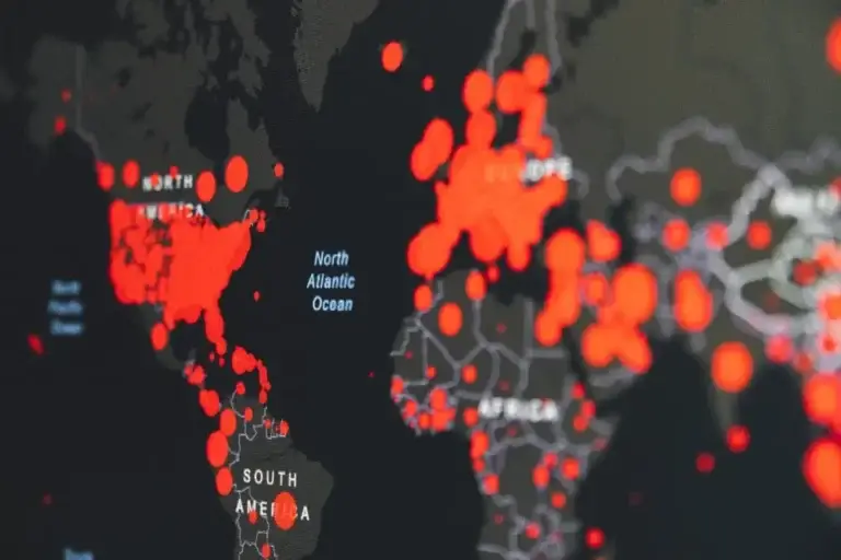
The 18th of November is international GIS Day – where we celebrate Geographic Information System (GIS) technology! For those of you who aren’t familiar with GIS, it’s a tool for gathering, managing, and analysing data that’s rooted in the science of geography, and the output is often in the form of maps.
Hundreds of thousands of organisations in virtually every field are using GIS to make maps that communicate, perform analysis, share information, and solve complex problems around the world. This is changing the way the world works and teaching STEM programs like how to fly a drone.

Brett Dascombe is a Geography teacher at Wavell State High School. He’s been working with ArcGIS (a major software for GIS) since 2001, where he used Version 2.3 (for reference we’re now up to Version 10.8!). He even spent two years working for the software company behind ArcGIS, called Esri (the Environmental Systems Research Institute).
During EduDrone, Brett shared some of the impressive work his students were doing using GIS. He also gave plenty of inspiring project ideas and key takeaways that you may want to use as guidelines for developing your own mapping curriculum!
One of the coolest new tools that Esri have released are ArcGIS Storymaps!
If you’ve never heard of these before, check out this video demonstrating a Storymap of a National Geographic expedition to Mt. Everest.
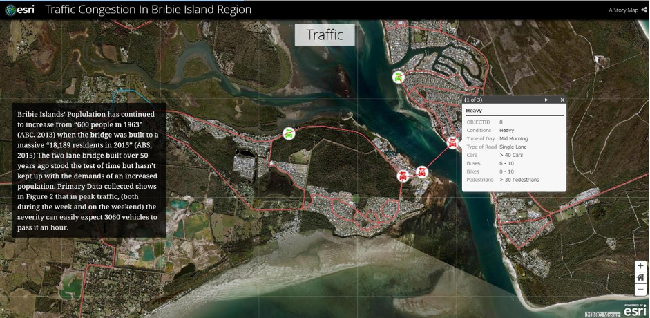
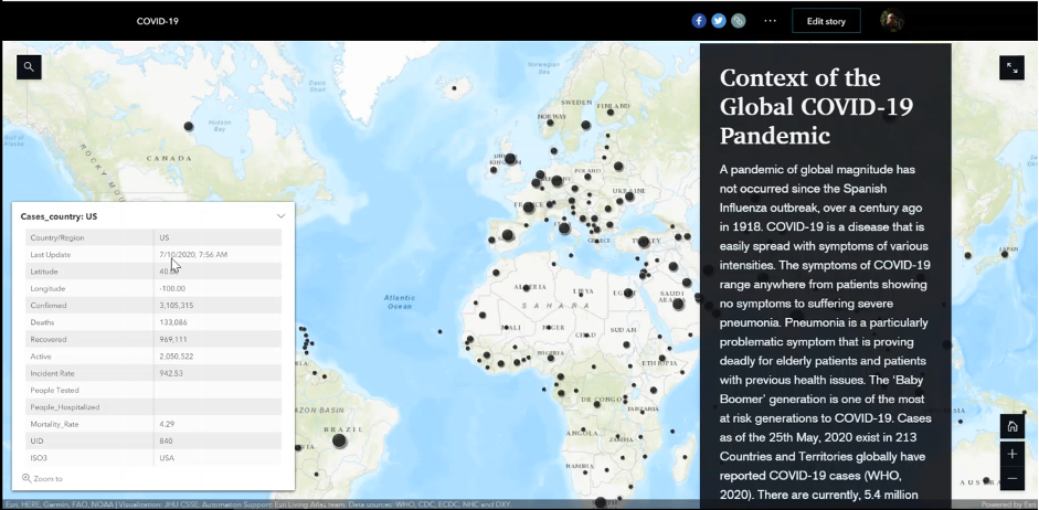
Brett’s students have been using Storymaps to present their assignments with some fantastic results! Take a look at these examples done by Brett’s Grade 10 students that use Storymaps to explore a local traffic congestion issue, as well as global scale dynamics of the COVID-19 pandemic.
Here are some other great project ideas which Brett has used for learning with spatial technology:
I think you’ll agree that the work that Brett’s students have produced is truly impressive for any age level, let alone Grade 10!
During his EduDrone 2020 presentation, Brett shared some of the inventive ways that he’s been able to encourage students to consistently improve and succeed. Some of these ways are as follows:
Anything involving a cash prize is pretty sure to get students attention! Brett has encouraged his students to enter their work into both national and international competitions. Winning isn’t important, but it gives the students something to strive for other than just an assignment grade.
Here are some of the competitions Brett is using to motivate his students:
2020 has seen many teachers and students transition to online learning, making teaching geospatial science for schools extra tough. But Brett found a unique way to support his students during the COVID lockdown. By creating a YouTube channel, he’s able to assist students with the transition to online learning.
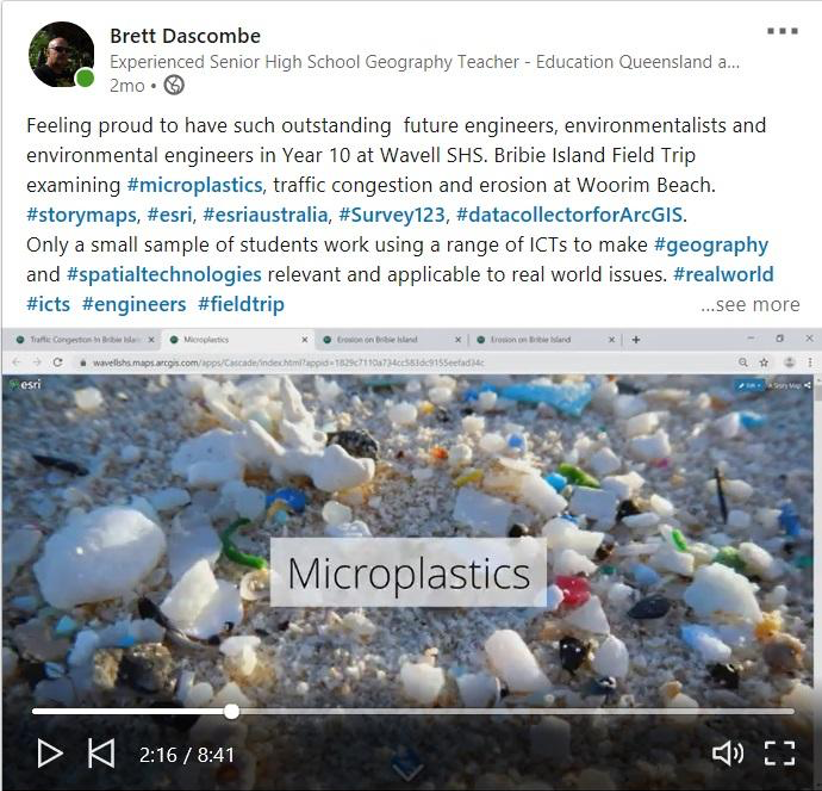
Not all teachers out there are using social media, but if you are, share your students work! Brett has been posting snippets of his student’s Geospatial assignments on his LinkedIn account, where it is seen by teachers, university professors, and industry professionals. One of his posts about an erosion project on Bribie Island received 1900 views – from people all over the world from Canberra to Dallas, Texas.
Just like at She Maps, Brett is passionate about teaching STEM and the power of spatial tech and geography to make positive changes in the world! He is always seeking to improve his own GIS skills and to come up with new and inventive project ideas for his students.
With hundreds of thousands of organisations across every field you could think of using GIS, it truly is a tool for the future! If you’re looking for project ideas or further inspiration for your Geography or STEM classroom, there are often local social media networks you can join, such as the QLD Senior Geography Teachers Facebook Page.
You can also reach out to us at She Maps! Let’s get geospatial in the hands of the next generation!
Check out Brett’s full talk from EduDrone 2020 and view his presentation slides here.
For more information on geospatial science for schools, read our blog about Why is Geography Excluded From Conversations About STEM Education?


