

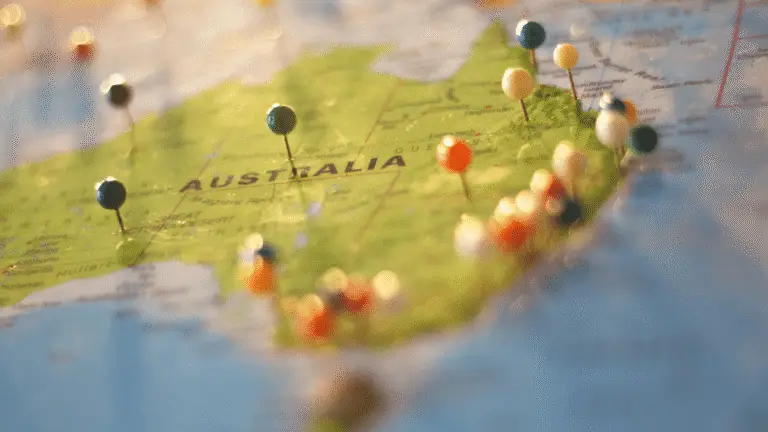
Geography has all the makings of a sexy discipline. There’s mystery and intrigue – why is there something there? Suspense – will it change over time? Care – why does it matter? And if you don’t find maps good looking, you just haven’t found the right map.
So, how come Geography is just not considered as sexy other subjects in STEM education?
We take a look at:
Geography is an example of an integrated discipline that cuts across all aspects of STEM in secondary schools.
So how does that even fit in?
It really struggles to.
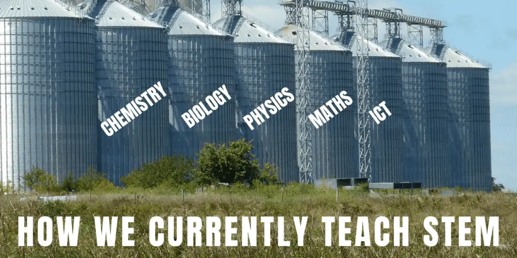
Our education system is very attached to making subjects structurally fit into an acronym. Science, Technology, Engineering, and Mathematics are viewed as separate subjects that sit in silos, which makes no sense in real-world situations.
In the real world, you take the discipline of geography and use:
Science – to ask questions about why we see different features in certain locations in the environment, and also to map and monitor changes across locations.
Technology – we use equipment such as GPS devices, laser scanners, and drones to help us gather the information we need.
Engineering – we build, use, and maintain hardware and software solutions, including field survey equipment.
Maths – we measure speed, distance, time, volume, area… all of which help us explain and understand environmental phenomena.
All of these areas contribute to our success in Geography – understanding the ‘why of where’.
Our education system’s way of teaching STEM in silos has made a lot of subjects seem ‘boring’ or ‘too hard’. Students opt for other subjects, they don’t enter STEM fields, and our STEM workforce finds itself in a place where it desperately needs more workers.
We know that STEM subjects can feel difficult for students but we really challenge this trope that they are ‘too hard’. Instead, we think that the challenges don’t seem worth working towards.
For instance, as educators, we all know that very few students like doing Maths for Maths’ sake. But in the real world, very few people in this field actually do Maths for Math’s sake.
Even the most famous mathematicians used and collaborated with other areas of STEM for a greater purpose, like Katherine G. Johnson, the NASA Mathematician whose mathematical calculations helped send the first Americans into space.

So why are we teaching our students STEM by making them work through textbook problems for the greater purpose of… working through textbook problems? Of course, they’re going to see this negatively!
Instead, using STEM disciplines like geospatial science for schools, we can get students working through real problems by using specific STEM skills (like the textbook problems) alongside other STEM skills to find a solution.
Just like how the discipline of Geography uses many areas of STEM to study the physical features of the earth and human activity on it.
National Geographic is a brand we know and love for its incredible documentation of the world. Do you normally register that it has geography in its name? The amazing images and documentaries we see of people and places aren’t what we associate with Geography as a discipline.
We generally associate Geography with flags, capital cities, landmarks — but Geography is much more dynamic, interesting, and inspiring than that, and much more relevant too.
Drones are legitimately sexy now. It’s true. In fact, some schools are incorporating drone lessons in their STEM curriculum.
Although drones had some bad PR when people thought they were only used for military purposes, it soon became clear that their possibilities were huge. And like most technology, they need checks and balances to ensure it’s a force for good.
Drones are now children’s toys. They deliver packages and monitor crops. And the possibilities are continuing to grow – just look at some of the ways they are beginning to be used in the COVID-19 pandemic.
Most people acknowledge that drone technology offers a good path for STEM professional development. But did you know that almost all drones use geographic technology?
Every drone knows where it is flying through at all times. It has a ‘positioning’ feature, which we commonly refer to as a GPS system – Global Positioning System. This ensures that the drone is flying safely with its speed and altitude known, and sometimes programmed where we want it to go, by using GPS. When drones take photos while they’re in the air they geo-tag that photo so we know exactly where and when it was taken.
Drones are an amazing tool to inspire people to think of geography in a new light — the one it deserves.
They’re also an amazing tool to actually use for geographical purposes, of course. We can study the environment, how it changes over time, how human and other activity is affecting it, and so much more. Mapping is a very typical example of how we record this information to process and understand it (the Science part of Geography).
First, a quick roundup of what we’ve covered:
Now, let’s look at an example of how a real-world application can be brought into the classroom:
Why?
We need shade on hot days to help keep our body temperatures down so we can feel great, and do the things we want to do. We also need to prepare for living in a warmer world. Climate science is strongly predicting a rise in air temperature over the coming years. Trees not only help to cool us down, they also absorb and store carbon dioxide emissions that contribute to our global warming problem.
How?
Trees provide obvious shade by getting in the way of the sun. But they actually provide more shade than a building because of something called ‘transpiration cooling’.
Transpiration cooling is basically sweating for plants and is a very cool example of how nature is incredibly smart. Trees need water to survive, which it will generally get from its roots. The water leaves the tree via leaves and branches (sweating) and this helps keep the plant cool. When the water evaporates off the plant, the water vapour helps cool the air around the tree by up to 5°C!
So, how cool do you think your school is?
To understand whether schools have enough shade, we need to find out how much tree shade they actually have. The best way to do that – a map, of course.
Using our Map My School resource, you can get your students to map the total area of your school, and the total area covered by trees, and then use these figures to calculate the percentage area of shade on your school campus. The great thing about this exercise is that it can actually be done drone-free if that’s not possible right now, using free geospatial technology.
What then?
Once we have this information, students can plan and present where the best places are to plant more trees to make their school even cooler.
It’s amazing how often something that is incredibly obvious – shade on a hot day – can be one of the most relevant ways to teach STEM in the classroom. Or to break it down by our STEM education system’s favourite acronym:
Science – We are asking questions about why shade is important, and why is it cooler under trees compared to undercover areas, or out in the full sun.
Technology – We are using software to gather and analyse the information.
Engineering – We have options to use and maintain data loggers to gather temperature information over time.
Mathematics – We are analysing the amount of shade on the school campus, by area, and working out the percentage of shade over the whole campus. We are using this information to help present a conclusion on why and where we need some more shade.
So what are you waiting for? Get started with our teacher resources with a She Maps Membership and get access to our curriculum-mapped ‘Map My School’ resources.
Learn how to incorporate a Geography course outline into your STEM curriculum here.
She Maps is Australia’s leading expert in drone and geospatial education.
She Maps assist schools with the purchasing of drones, school-industry created drone and geospatial teaching resources and highly supportive teacher professional development.

Subscribe by email and never miss a blog post or announcement.
Take our resources for a spin and join the thousands of teachers who love our ready-to-teach classroom materials. Try one of our complete units of work for free.


