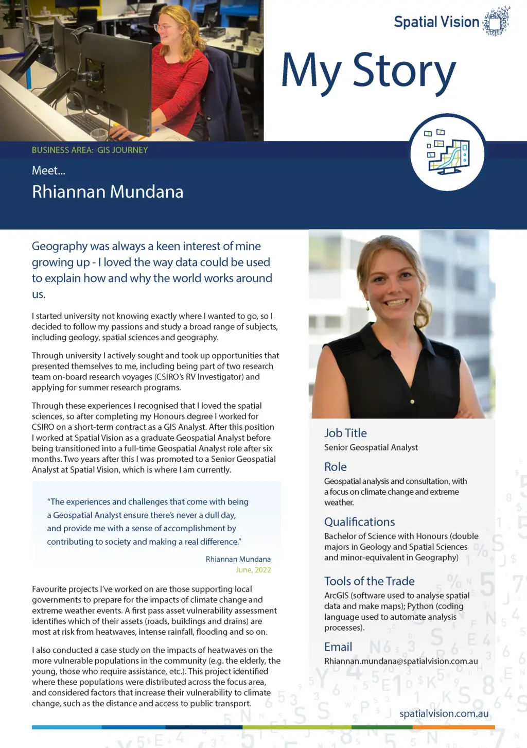
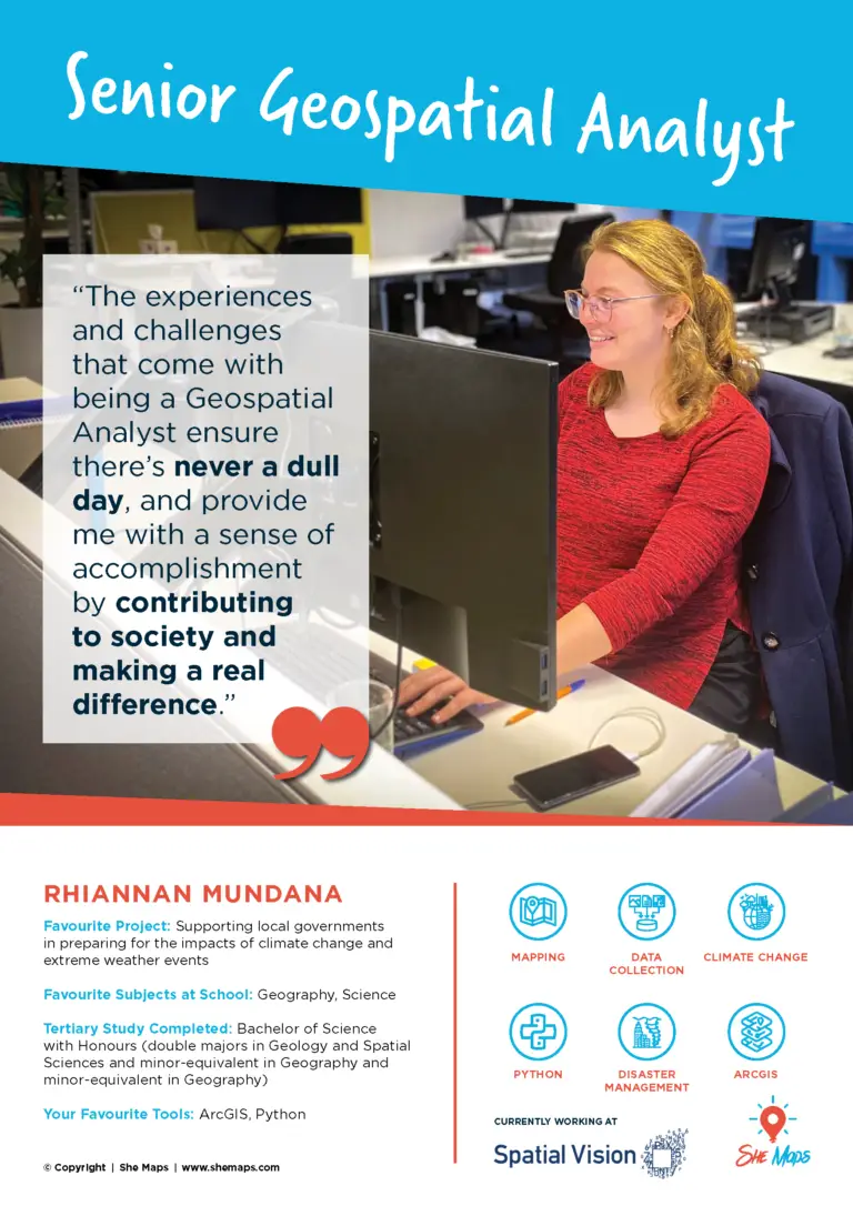
Spatial Vision – A Melbourne based geospatial company discusses how they are addressing underrepresentation of women in the industry
Spatial Vision was founded in 1999 to work alongside like-minded organisations and government departments to solve their spatial, social and environmental challenges.
They’re guided by their passion and curiosity for what’s possible with geospatial and information technology, and work closely with clients to understand their problems and find intelligent, engaging solutions.
“As the only female to graduate in my geospatial cohort, I know first-hand what it’s like to be in a male-dominated environment.
While things are changing, it’s not much different beyond the classroom. In fact, women+ make up less than 25% of the Australian Spatial Industry workforce, with even less representation in positions of leadership.” says Rhiannan Mundana
But it doesn’t have to be this way, Spatial Vision has two programs to support and mentor women in the field early on, so they can pave the path for greater female representation.
Read more about these initiatives, and meet two of the recipients Rhiannan and Bianca below.
Geospatial Scholarships
“One way Spatial Vision is addressing this underrepresentation of women in the industry is through our Women in Geospatial Scholarship in partnership with RMIT University. The scholarship is awarded annually to a high-achieving undergraduate female student studying Geospatial Sciences at RMIT. Not only does this student receive a financial incentive to support their studies, but it also gives the student an ongoing one-on-one mentoring opportunity with female employees at Spatial Vision.” Read More
Geospatial Cadet Programs
Spatial Vision’s Graduate and Cadetship Program offers a 12-month opportunity to apply and develop your skills and experience.
During the 12 months, participants can explore different areas of specialisation, gain real project experience and see the inner workings of a successful software and spatial professional services company.
Each year we invite applicants across different streams and offer a tailored experience to the successful candidate and their interests.
To find out more about the GeoSpatial Cadet Programs, click here.
Rhiannan Mundana - Senior Geospatial Analyst
What are some of your favourite projects that you’ve worked on?
- Supporting local governments in preparing for the impacts of climate change and extreme weather events by conducting a first pass asset vulnerability assessment to identify which of their assets (roads, buildings and drains) are most at risk of being impacted by climate change (e.g. heatwaves, intense rainfall, flooding, etc.)
Conducting a case study on the impacts of heatwaves on the more vulnerable populations in the community (e.g. the elderly, the young, those who require assistance, etc.). This project identified where these populations were distributed across the focus area, and considered factors that increase their vulnerability to climate change, such as the distance and access to public transport.”
Bachelor of Science with Honours (double majors in Geology and Spatial Sciences and minor-equivalent in Geography)
ArcGIS (software used to analyse spatial data and make maps); Python (coding language used to automate analysis processes).
Bachelor of Science with Honours (double majors in Geology and Spatial Sciences and minor-equivalent in Geography) ArcGIS (software used to analyse spatial data and make maps); Python (coding language used to automate analysis processes).
My career so far…..
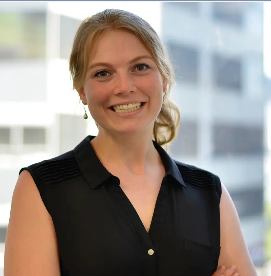
“Geography was always a keen interest of mine growing up. I loved the way data could be used to explain how and why the world around us works.
I started university not knowing exactly where I wanted to go, so I decided to follow my passions and study a broad range of subjects, including geology, spatial sciences and geography.
Through university I actively sought and took up opportunities that presented themselves to me, including being part of two research team on-board research voyages (CSIRO RV Investigator) and applying for summer research programs.
Through these experiences I recognised that I loved the spatial sciences, so after completing my Honours degree I worked for CSIRO on a short-term contract as a GIS Analyst. After this position I worked at Spatial Vision as a graduate Geospatial Analyst before being transitioned into a full-time Geospatial Analyst role after six months. Two years after this I was promoted to a Senior Geospatial Analyst at Spatial Vision, which is where I am currently.”
What I love about my role!
The experiences and challenges that come with being a Geospatial Analyst ensure there’s never a dull day, and provide me with a sense of accomplishment by contributing to society and making a real difference.
Read more about Rhiannan journey here.
Bianca Fichera - Graduate Spatial Cadet
Current Job Title
Graduate Spatial Cadet
What tasks do you do in your role?
Assist senior spatial analysts and cartographers in creating and designing maps, analysing spatial data to solve spatial problems. Spatial data involves any data that has a location. Due to being a graduate, my tasks involve lots of learning from my team.
What industry do you work in currently?
Geospatial Science/GIS
What are some of your favourite projects that you’ve worked on?
I am currently working as a part of a project that focuses on investigating the resilience of communities from certain council areas against the effects of climate change.
What were your favourite subjects at school?
I loved Geography and Visual Communication and Design.
What did you study at University?
I studied a Bachelor of Geospatial Science (Honours) at RMIT University and graduated in 2021.
What are your favourite tools that you use in your job?
Our main tool is a computer, so my favourite programs we use are Adobe Illustrator and ArcGIS.
My career so far…
I graduated in 2021, so my career has been a short one, but definitely not a boring one. A career in geospatial science is so much more than creating maps. It’s understanding our world and its problems from a spatial lens. The professional world of geospatial science has been very welcoming and understanding of the learning curve graduates face. It has been a constant learning experience but granted with independence to apply what I’ve learnt on my own, in a hands-on environment.
What I love about my role!
They say a picture speaks a thousand words, so do maps. This makes every project unique, each day is a different learning experience.
Career Posters
Bianca and Rhiannan are part of the She Maps Women in STEM Career inspiration poster series. Click here to see more view all our posters, or click the images below to download their individual posters.