The role of Geospatial Science in Social Media – STEM Career Series
She Maps Team
20 Sep 2021
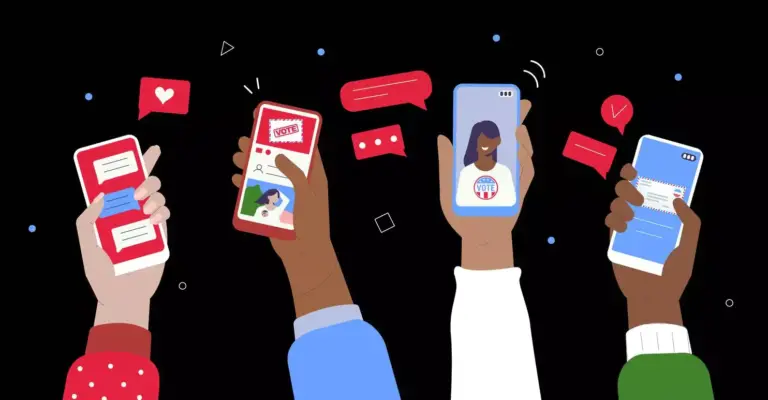
Clicks. Likes. Reactions. Emojis. More Clicks. More emojis. Do these actually do more than give us an instant gratification? Today more than ever, we are bombarded with information and advertisements on every digital platform, a stream of photos, commentaries, reels, and so on. Our posts and clicks unknowingly can contribute to helping some of the biggest challenges we face in the community today.
Have you ever wanted to purchase a product, and then saw your social media feed flooded with the product from nearby stores? And then you think, how do ‘they’ know I was looking for this ?
This is nothing but one of the many fascinating outcomes of combining user data with geospatial science! When you post a story or post on Instagram, with the location tag, the algorithms which are constantly at work in social media become aware of your location and store it in the database. This is how these algorithms can provide you with suggestions of products you were googling for in stores within your reach. This may sound creepy, but its implications are much more than providing an enhanced online shopping experience. Geospatial science plays a massive role in:
Allocate emergency medical supplies to affected regions
Understanding housing trends
Influencing voting sentiments
Geospatial Science in the Distribution of Medical Supplies
The threat posed by COVID-19 is one of the biggest ever in the human history. There is severe strain on available resources with lockdowns and isolations making the situation ever worse. In such an unstable climate, it is extremely important for researchers and medical professionals to analyse the spread of the disease in a given area so that resources can be allocated efficiently. Unlike the Spanish flu, today thankfully we have access to social media from the comfort of our isolated homes. We may not realise it, but it is one of the most powerful tools we can equip ourselves with.
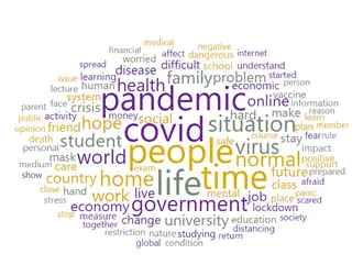
In US, tweets from people who experienced COVID-19 symptoms and those who were tested positive were collected from the Twitter API stream. Using advanced data analysis techniques, classifiers were built which can identify and group similar tweets together, forming clusters. Geospatial clustering was further able to assess the top 5 cities in US with the fastest spread of the disease. This gave medical professionals an opportunity to inform hospitals beforehand of the expected surge, giving them time to prepare for it. Softwares such as SMART(Social Media Analytics and Research Testbed) developed by Centre for HDMA, provide real time statistics on the current trends on social media platforms. This geo-targeted tool helps answer the questions such as : What is the most commonly used word on posts in the last 24 hours? In which city have posted the most this week?
An example of this can be visualised as word cloud, where the bigger the font, the more popular the term is on social media.
These tools have been around to track the spread of Ebola, Ovarian Cancer, as well as the use of marijuana in certain locations and have provided enormous data which helps the government provide resources in the best possible way.
Geospatial Science in understanding Housing Trends
Using location services on social media also helps researchers identify the demographics and trends of certain regions, enabling better development of the areas. This has been implemented in Beijing, China where researchers collected over 9.5 million from Sina Weibo social platform with geotags attached. Urban city planners use this data to analyse where the population is higher, what are the current trends in the society , and what are people’s interests like. Ultimately, this leads to better and customised catering of the community . For example, knowing that more people are going to McDonalds in a certain district indicates the eating patterns of the community. This would in turn be used to promote novel healthy eating ideas and recipes on social media, targeting the specific group of people in the area. Who knew that the smallest of our actions on social media, can have huge impacts ?
Controversial Aspects
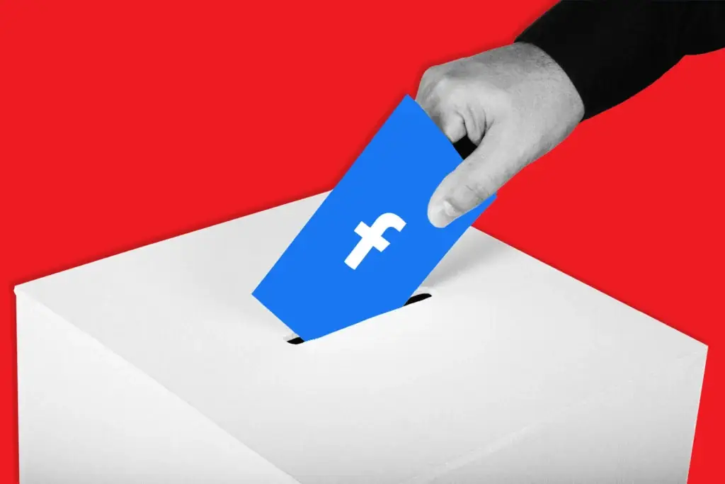
Influencing voting sentiments of people made the headlines in the US presidential elections in 2016. Technology giants such as Facebook were accused of influencing how the voters feel about a given presidential candidate. How can a social media platform change the way we think, something which is completely up to us?
Using location services on social media platforms, some companies acquire large amounts of user data and might misuse it. By using targeted messaging, we may see campaigns of a particular party always in a positive light, while others always in a negative light. Ultimately, this influences the voters’ sentiments as we get drawn towards a certain candidate. Spread of misinformation and election meddling were of enormous concern in the elections, leading to lawsuits and endless courtroom drama. This goes to show just how crucial data is; and when social media meets geospatial data, the impact can be massive. More importantly, it highlights the need to keep user data secure to make sure use privacy is respected.
GIS Careers in the Media Industry
Some of the career opportunities in this industry are listed below.
Data Manager : This role involves using large amounts of data and performing analytical work with it to provide strategies and recommendations to key stakeholders. Instagram is one of the biggest employers in this field! Marketing is another crucial skill which when paired with spatial analytics has the potential to reach to millions of people. Check out the opportunity here!
Software Analyst : Building new and creative application experiences for social media platforms is one of the key roles. Using iOS programming and software components, analysts optimise infrastructure application codes and boost performance of the system.
Security Architect : Data security is extremely crucial in this field and user data should be kept secure at all times. This role involves designing and maintaining the security software’s to make sure they are robust and secure. Jobs are available across all industries. Check out an opportunity here!
If you enjoyed this article, then you might want to read more in our STEM Career Series:
She Maps is Australia’s leading expert in drone and geospatial education.
She Maps assist schools with the purchasing of drones, school-industry created drone and geospatial teaching resources and highly supportive teacher professional development.
FREE eBook – How to start a drone program at your school – Teachers Guide – Download Now
Learning Solutions Guide – Programs, Products and Pricing Guide – Read now
Ready to buy drones for your school? Browse our convenient classroom kits!
You’re in Safe Hands!
She Maps is a CASA approved commercial operator to fly microdrones indoors with students and teachers. CASA holds commercial operators, to a higher standard than recreational users and educators. This means that She Maps has been assessed by CASA as having rigorous training and risk mitigation procedures in place.
Want some help?
Schedule a call with one of our team members to get some personalised recommendations.
Take our resources for a spin and join the thousands of teachers who love our ready-to-teach classroom materials. Try one of our complete units of work for free.