

Many of us see surveyors working with their tripods by the roadside. However, we have a limited understanding of what it is they do or just how different and exciting their jobs can be. We’re on a mission to showcase geospatial science for schools and surveying!
We’re teaming up with a number of young surveyors across the world to bring you their favourite projects and what they love the most about working as a surveyor.
Surveying is the measurement and mapping of our surroundings using mathematics, specialised technology and equipment. Surveyors measure just about anything, from buildings and structures, to the land, the sky or the ocean bed. They even measure polar ice-caps!
Whilst surveyors use maths skills and technology to do their jobs, there is also a strong link to Geography. Surveyors use geographical inquiry skills on a daily basis to observe, question, and plan how to solve problems. They collect, record, and represent information and data from a variety of sources.
Once they have this information, then they make interpretations and conclusions, then communicate these results and findings to a wide variety of audiences.
This series showcasing surveyors is designed to show students and teachers how their STEM education for secondary schools curriculum can be bought alive in real-world examples.
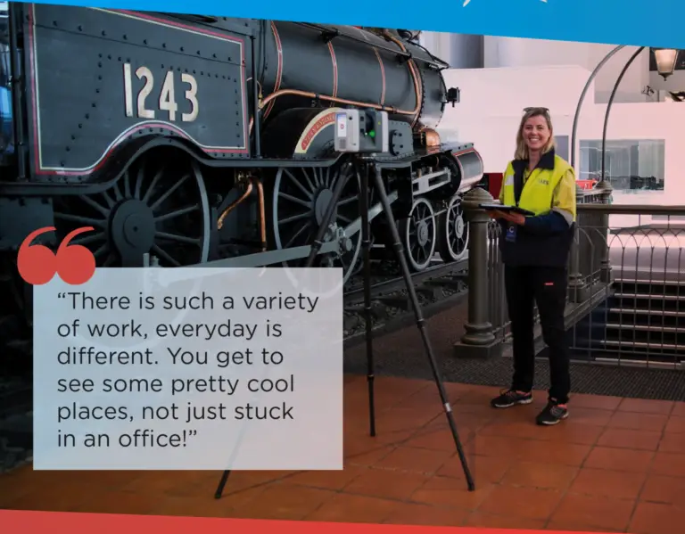
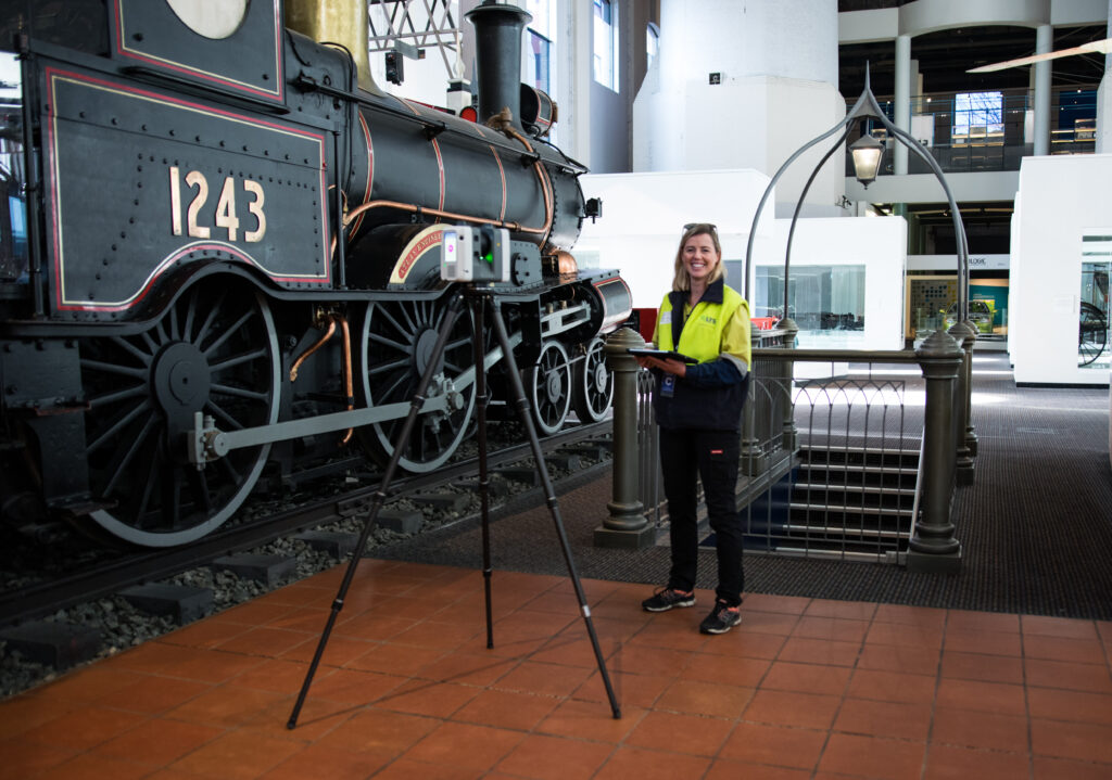
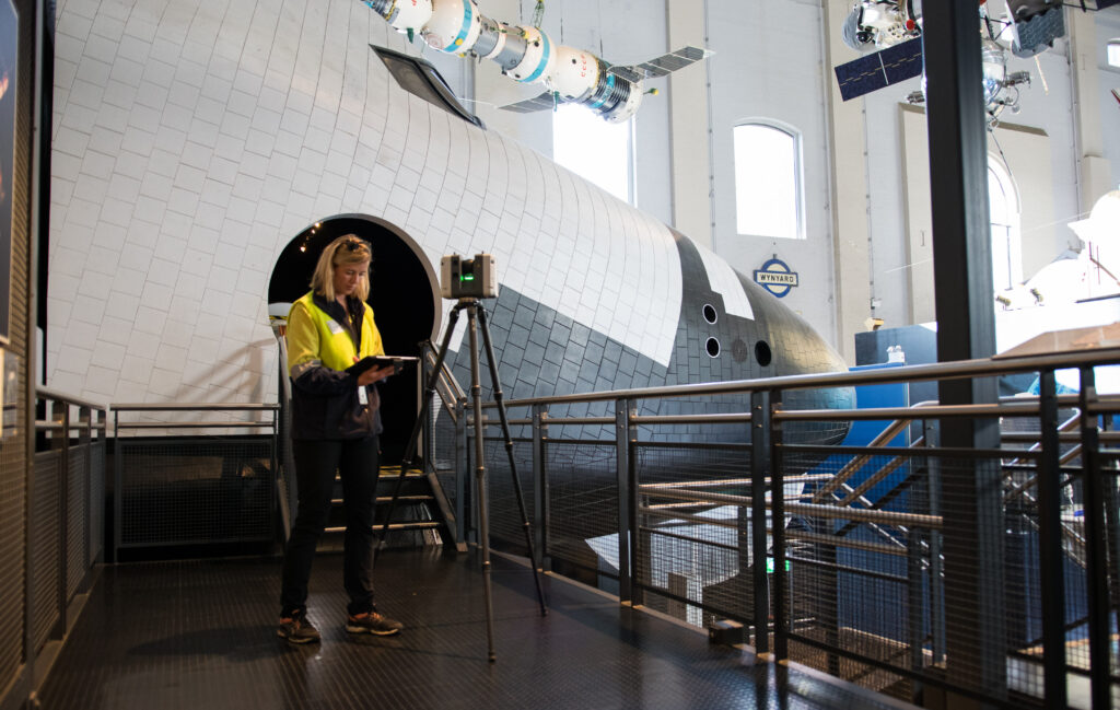
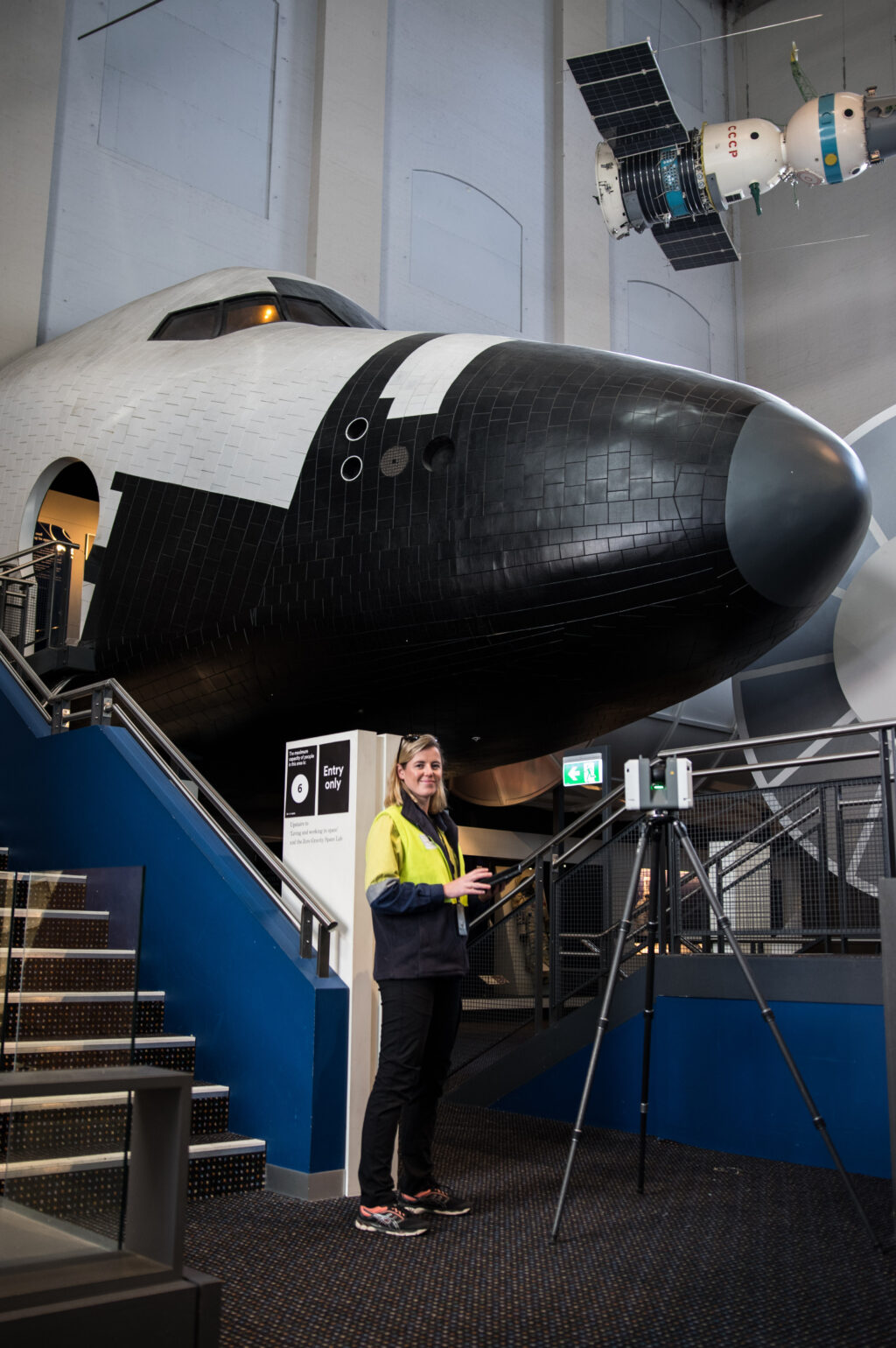
Georgia is a Land Surveyor based in Sydney, Australia. She has a Bachelor of Surveying, and became a fully Registered Surveyor in New South Wales (NSW) in 2019. Her favourite subjects in high school were geography, maths, physics, and physical education (P.E). Georgia’s favourite project has been surveying the Powerhouse Museum in Ultimo as part of the renewal of the Museum.
The Powerhouse Museum was not always a museum. The original building, constructed in 1902, was a power station used to operate Sydney’s electric tram system – called the Ultimo Power Station. After the Sydney tram network closed, the power station was decommissioned in 1963. Twenty-five years later the building was converted into what is now the Powerhouse Museum.
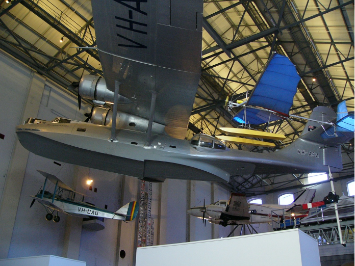
The Powerhouse Museum houses one of the earliest rotative (wheel-turning) steam engines in the world, the Boulton and Watt Engine. It also houses Locomotive No. 1, which hauled New South Wales’ first train, and the Catalina flying boat ‘Frigate Bird II’, the first plane to successfully fly over the South Pacific Ocean between Australia and South America. Georgia was brought in to create a highly detailed and accurate floor plan showing all the structural elements of the building such as walls, columns, windows and doors.
Georgia was faced with a very large task. The main museum building contains five levels, three courtyards and a cafeteria, as well as offices. The roof of the building is so high it was impossible for Georgia to get access! For a building as large as this, 3D scanning was the only option. Georgia had to complete the scanning in smaller sections and then stitch them together for the final product, because the software simply couldn’t handle such a large amount of data.
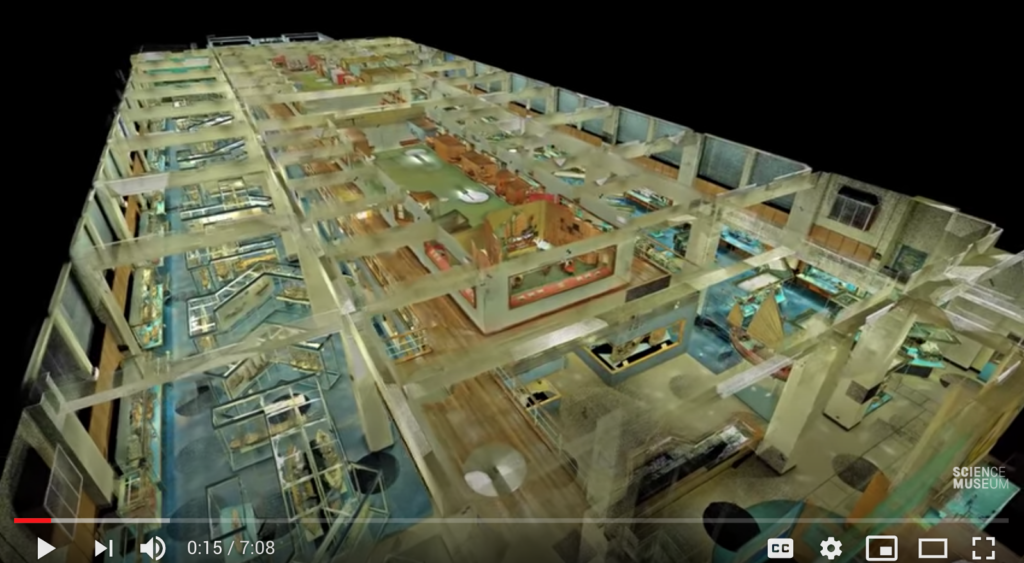
To capture this huge building, Georgia gathered BILLIONS of points of 3D data! There were 1500 scans which totalled 100GB of data. She imported all of this 3D data into the computer software and then traced all of the structural features such as walls, columns, stairs and lifts using a computer software called Auto-CAD. This allowed her to create a detailed 2D floor plan showing all of the heights of the floors, ceilings, windows and doors. She was also able to create a 3D fly-through of the building. This has been done in other museums around the world to capture their collections virtually, check out this video of a 3D Point Cloud flythrough of the Science Museum in London.
The 2D floor plans and 3D model that Georgia produced of the Powerhouse Museum will be used by architects, engineers, and project managers. The plans are important for ensuring that the structural integrity of the building is maintained, and to detail all of the aesthetic features of the building.
Georgia had to maintain good communication with museum security at all times. They needed to know exactly where Georgia was whilst she was capturing her scans. During this project, she also learnt how to work within the limitations of the computer software in processing very large data sets. Breaking down the projects into smaller sections allowed for faster data processing, but required Georgia to carefully plan her scans ahead of time.
Georgia never imagined working on a project like this when she started out in surveying. Ten years ago, the technology for 3D scanning was only just being developed! Now it is so fast and accurate that it makes huge jobs like the Powerhouse Museum much easier for surveyors to complete. When asked what was special about working on this project, Georgia said:
“It was a great experience to be a part of preserving and improving this historic building. We have created a snapshot in time of what the museum looked like. Maybe one day in the future our digital 3D model will be featured in the museum for users to virtually walk through!”
For more inspiring stories, read our post about 5 of the most surprising careers with STEM Geography and drones.


