How aerial imagery, maps, and real people are helping us understand and care for our world
At She Maps, we’ve always believed that maps are more than tools; they’re invitations. They help students see the world differently, ask sharper questions, and understand how places, people, and environments are connected.
As part of our work with schools across Australia, we’re updating all our image mats with richer, more detailed geospatial data. This upgrade has been made possible through the generous support of Nearmap, and we want to highlight the important work they do and why it matters for students.
A new way of seeing the world
Nearmap is an Australian geospatial technology company that captures detailed images of the Earth from above using planes. Their aircraft regularly fly over cities, towns, coastlines, and natural landscapes, collecting high‑resolution imagery that shows what places look like now and how they’ve changed over time.
Because Nearmap updates its imagery frequently, users don’t have to rely on outdated information. For teachers exploring land use, councils planning for flooding, or students investigating environmental change, having the most recent version of a place is essential.
Making mapping language simple
Terms like “geospatial” or “aerial imagery” can sound complex, but the ideas behind them are surprisingly straightforward.
Aerial Imagery
Photographs taken from the air, usually from planes, let us look straight down at the Earth’s surface.
Geospatial Data
Information tied to a specific location, such as the shape of a river, the height of a building or the path of a road.
Nearmap transforms imagery into measurable, analysable information. Distances, areas, heights, changes over time, this is the kind of data professionals use every day in mapping, science and technology. When students use this data, they’re stepping directly into the world of spatial thinking.
One of the most powerful aspects of Nearmap’s work is the ability to track change. By comparing imagery captured months or years apart, users can see how places evolve—new housing developments, shifting coastlines, changes in vegetation, or the impact of natural disasters.
In Australia, where landscapes can transform rapidly due to bushfires, floods or storms, this kind of visual evidence helps communities understand what has happened and plan for what might come next.
Caring for the environment from above
Nearmap’s imagery is widely used in environmental monitoring, tracking rivers, wetlands, vegetation and wildlife habitats. Aerial views help scientists and land managers understand how waterways shift and how those changes affect species like the platypus.
Seeing the landscape from above allows issues such as erosion or vegetation loss to be identified early.
For students, this is a powerful reminder that maps can help us care for the natural world.
Supporting communities during disasters
During natural disasters, clear and current information can save lives. Nearmap imagery has supported emergency responses during bushfires, floods and severe storms by showing which areas are affected, which roads are accessible, and how the landscape has changed.
This highlights the deeply human side of geospatial technology. Maps aren’t just about data—they’re about people, safety and resilience.
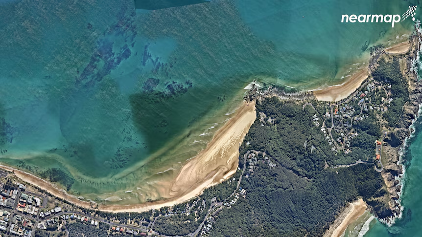
Climate change can feel abstract, especially for young people. Nearmap’s imagery helps make it real. Repeated images of coastlines, such as those around Byron Bay, show erosion, recovery, and long‑term shifts after major weather events.
This aerial image from June 2021 shows the build-up of sand near The Pass and Clarkes Beach. (Supplied: Nearmap)
These visual stories help students understand why action matters and how climate impacts different places.
The people behind the maps
Nearmap isn’t just planes and pixels; it’s people. The spatial industry is highly collaborative, bringing together scientists, analysts, software developers, designers, communicators, and more.
There’s no single “type” of person who works in mapping. Curiosity, problem‑solving, and a willingness to learn are just as important as technical skills.
Pathways into the spatial industry
For students who enjoy geography, science, math, technology—or even art—the spatial industry offers a wide range of pathways, including:
Spatial science
GIS analysis
Surveying
Environmental science
Software development
Data analysis
Many people in the industry didn’t follow a straight path. What they share is a desire to understand the world and use data to answer meaningful questions.
The following are a list of the study paths taken by some of the NearMap team.
MA, Information Resources and Library Science
Bachelor of Science (B.S.), Civil Engineering, concentration in structures, minor in architecture
B.SC, Electrical Engineering
BA, Politics and International Relations
Why this matters for schools
Using real aerial imagery in the classroom helps students connect learning to the real world. It builds spatial awareness, critical thinking and curiosity about how places work.
By updating our She Maps image mats with Nearmap data, we’re giving teachers and students access to the same tools used by professionals across Australia.
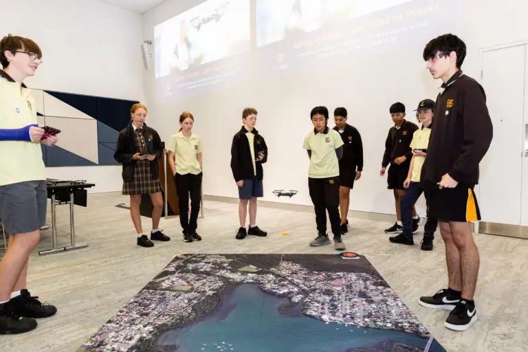
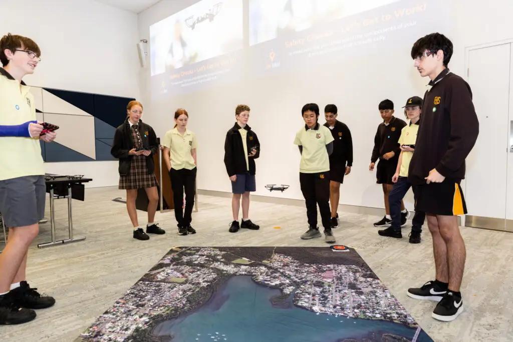
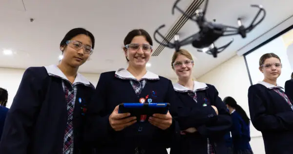
Students using image mat to simulate drone flying over an identified area
About She Maps.
She Maps is Australia’s leading expert in drone and geospatial education.
She Maps assist schools with the purchasing of drones, school-industry created drone and geospatial teaching resources and highly supportive teacher professional development.
FREE eBook – How to start a drone program at your school – Teachers Guide – Download Now
Learning Solutions Guide – Programs, Products and Pricing Guide – Read now
Ready to buy drones for your school? Browse our convenient classroom kits!
You’re in Safe Hands!
She Maps is a CASA approved commercial operator to fly microdrones indoors with students and teachers. CASA holds commercial operators, to a higher standard than recreational users and educators. This means that She Maps has been assessed by CASA as having rigorous training and risk mitigation procedures in place.
Want some help?
Schedule a call with one of our team members to get some personalised recommendations.
Take our resources for a spin and join the thousands of teachers who love our ready-to-teach classroom materials. Try one of our complete units of work for free.