GIS Careers in Space, Geographic Information Systems
GIS Careers in SPACE – The fact that we can view detailed maps of a planet 385 million km away from Earth while sipping a latte in a café is simply mind-blowing.
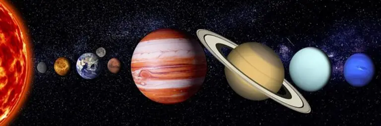
As kids, we look up at the sky and wonder: Why is the moon following me wherever I go? As we grow up, we then begin to understand the concepts of gravity and orbits. Then we add planets to our knowledge of astronomy. Mars is red and stormy, moon is rocky, Jupiter is volcanic, so on and so forth. But wait a minute. How do we exactly know all this as a fact? No human has placed foot on any other planet. Yet we have a reliable source of information lightyears away from earth which helps in understanding our observable universe . Thanks to Geographic Information Systems (GIS), we can explore detailed maps of distant planets, providing us with insights into the far reaches of the universe.
Geographic Information Systems (GIS) comes to the rescue here, giving us unworldly insights, literally. Computer based insights collect and integrate information from different sources, to map the terrain and properties of earth and other planets. So, what information can GIS give us?
Map surface of celestial bodies
Obtain data from unmanned missions
Predict changes in mineral composition
Explore the existence of extra-terrestrial life
Internet Mapping Technologies
Remote sensing is a key GIS technique that gathers data from a distance, helping scientists study celestial bodies through satellites and probes placed in various orbits. When we talk about space, the distances we are accustomed to here on earth, multiply exponentially. This makes celestial bodies exceedingly remote. Hence, the need for remote sensing. It is a fast-emerging field which demands geospatial science analysts to put satellites and space probes into Low Earth Orbits (LEO) as well as other planets orbits. Two of the most commonly used mapping technologies are Google Earth and Microsoft Virtual Earth, which are open source, making them easily accessible to all. These tools enable accurate coordinate locations and allow us to view Earth from a different vantage point. These maps are populated by images from satellites in space which offer highly accurate details of the landscape, both here on Earth as well as outer space. Try finding your house/school in Google Earth! Did you find it difficult? Think about what the challenges would be if the planet imagery was of a very poor resolution, as it is in real missions.
Map celestial bodies
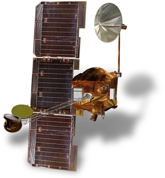
When satellites and probes reach planetary orbits, GIS helps us map and understand the terrain and properties of celestial bodies.. Today we have enormous data of the Martian terrain and its geophysical properties. Thanks in part to NASA’s Mars Odyssey mission , we now know that the red planet which is located more than 142 million miles from the Sun has a rocky and volcanic surface. Dry lake beds cover the surface, presumed to be huge water bodies potentially harbouring some form of life in the past. Detailed exquisite maps of the surface have been generated by its THEMIS (Thermal Emission Imaging System) camera system. It uses infrared and visible light reflections off the surface of Mars to analyse the mineral concentrations present in different locations and displays them on a map. By doing this, scientists could analyse these concentrations of minerals to understand if Mars had the essential building blocks for life to thrive in the past.
odyssey orbiter
JMARS (Java Mission-planning and Analysis for Remote Sensing) is a GIS system developed by Arizona State University’s Mars Space Flight facility which aims to provide NASA scientists with necessary tools to further understand the geographical properties of Mars. This is an excellent tool to bring to the classrooms as it provides an opportunity to investigate maps on particular region of Mars and view its properties such as temperature, elevation, etc. Various maps of temperature, topography, composition, etc. are available to the viewer to have fun with. You can download the software here!
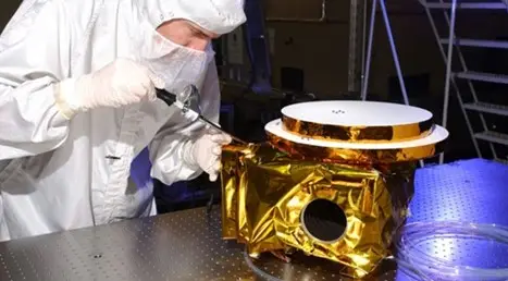
The technique of mapping planets with the help of advanced imaging systems has also been used by the New Horizons mission which aims to understand the properties of Pluto. The Ralf instrument which is mounted on the New Horizons orbiter, provides coloured and monochromatic maps of Pluto’s surface. Essentially it is an imager and spectrometer whose role is to generate maps based on the data captured from cameras. It has helped in understanding several of Pluto’s properties such as:
Geology
Form
Structure
Surface composition
Surface temperature
ralph imaging device
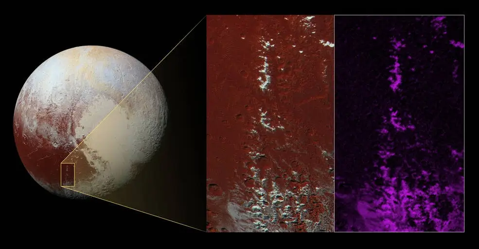
It indicates the presence of gases such as nitrogen, methane, carbon monoxide and others on the maps. For example, the bright spots in the middle of the red region are captured by Ralf and corresponds to the exact distribution of methane, which is represented in the purple colour. It can be concluded with reasonable certainty that the large red area of Pluto has methane content.
methane snow on plutos peaks
GIS Careers in the Space Industry
Some of the career opportunities in this industry are listed below.
CAD Designer: Primarily responsible for using computer aided designs to analyse and create 2D and 3D drawings which enables engineers to simulate planetary motion.
Space Systems Engineer : Collect, and process large amounts of data to solve engineering problems. System analysis such as sensor characteristics, fault management, etc. are some of the exciting duties of this role! More information about this role can be found on Gilmour Space Technologies job opportunity.
Software Developer/Engineer: Assist in creating and maintaining software’s which are responsible for communicating with probes, as well as software’s responsible for processing geospatial data. Some examples of such roles can be found here.
Data Scientist: Process empirical and simulation data sets which include imaging data from missions, survey data from exoplanets, and analyse sky surveys at different optical wavelengths.
Research Assistant: Further explore the ways to improve current imaging and mapping systems onboard space missions by carrying out extensive testing. CSIRO is an excellent place to engage in research on this, especially with their summer vacation undergraduate program which dives into astronomy and technology. Students get a chance to collaborate with leading CSIRO scientists and contribute to projects spanning from interpreting radio waves, to mapping surfaces, to developing code for processing large amounts of observational data. Definitely something to look out for!
Also keep your eyes peeled for the recruitment in companies such as Gilmour Space technologies, Saber Aeronautics and Neumann Space that provide space visualisation products, satellite launches, and much more!
For more information about careers within Drone and Geospatial industries, check out these articles:
She Maps is Australia’s leading expert in drone and geospatial education.
She Maps assist schools with the purchasing of drones, school-industry created drone and geospatial teaching resources and highly supportive teacher professional development.
FREE eBook – How to start a drone program at your school – Teachers Guide – Download Now
Learning Solutions Guide – Programs, Products and Pricing Guide – Read now
Ready to buy drones for your school? Browse our convenient classroom kits!
You’re in Safe Hands!
She Maps is a CASA approved commercial operator to fly microdrones indoors with students and teachers. CASA holds commercial operators, to a higher standard than recreational users and educators. This means that She Maps has been assessed by CASA as having rigorous training and risk mitigation procedures in place.
Want some help?
Schedule a call with one of our team members to get some personalised recommendations.
Take our resources for a spin and join the thousands of teachers who love our ready-to-teach classroom materials. Try one of our complete units of work for free.