In the 1980s, Melinda Clarke used to get up at the crack of dawn to jump in the hot air balloon that flew over Melbourne city. In place of a champagne flute and a picnic basket, Melanie had a camera. And with that camera she took 7500 photos of Melbourne. These would become the basis of the Melbourne Map – a map that has captured the hearts of Melbournians when it was released 30 years ago, many of whom still recognise it from their own homes and classrooms.
At the time, Melinda didn’t really understand that what she was doing was in the field of mapping, she just loved using creativity to make a visual representation of a city she loved, complete with cute detailed illustrations.
As she puts it, people are drawn to maps because they’re a journey of familiarity and discovery. Particularly a map of a place you might know.
Watch her infectious enthusiasm for creating this masterpiece below and how she went about making the new 2017 map:
The streets might have stayed the same in 30 years, but the buildings have very much changed. One Kickstarter campaign, two and a half years to re-document the city and a total of four years later, the new Melbourne Map was born. Now that Melinda understands mapping and the technologies around it, she brings a fresh take to inspiring a new generation. That of creativity, a crucial skill in STEM education.
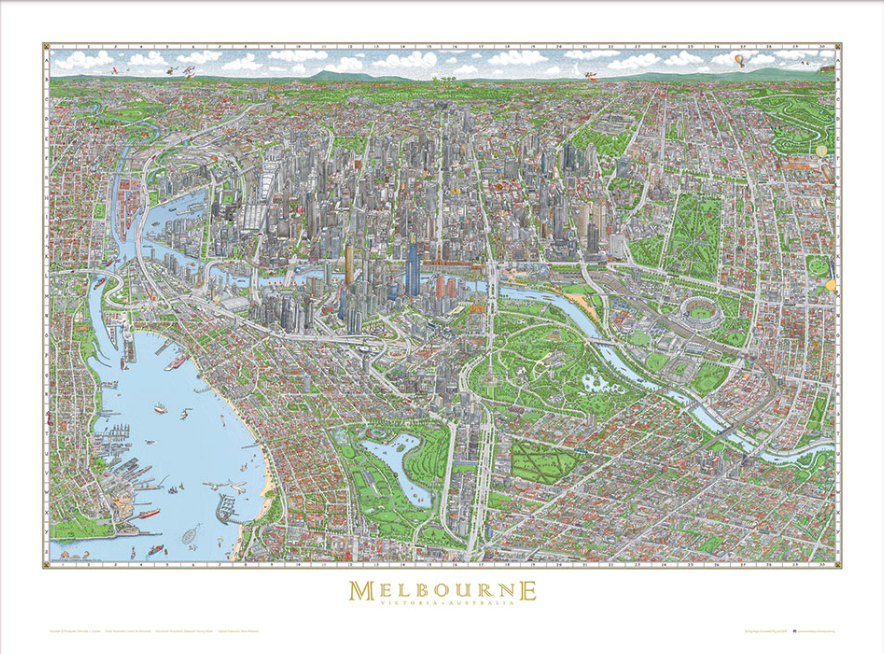
The new 2017 Melbourne Map
The attention to detail, thought and affection that has gone into the new Melbourne Map is a great way of communicating a sense of space and placement in a way that resonates with people. It also makes a great Christmas present! Check out the Melbourne Maps range that includes a calendar, posters and jigsaw puzzle. View the range here.