ArcGIS StoryMaps: Digital Storytelling in the Classroom?
Guest Author
24 Jan 2025
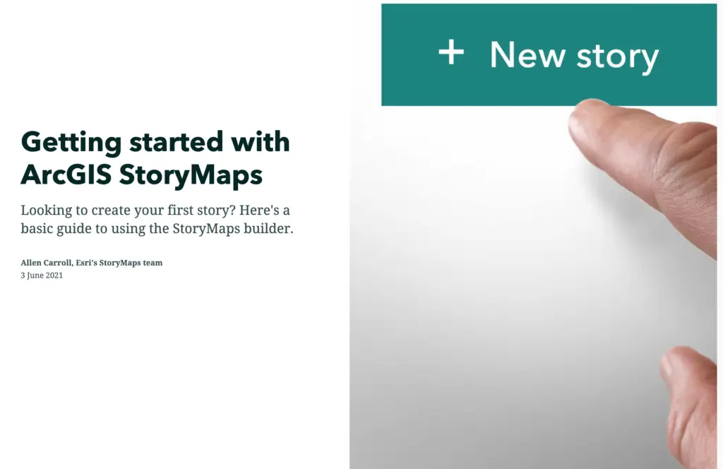
If you haven’t discovered ArcGIS StoryMaps yet, then read on.
You might be a teacher, student or researcher; you might work for the government, industry or own a business; you might be a historian, an artist or just have a keen interest or hobby. You don’t have to be a cartographer or web expert to create a StoryMap and everyone can use one just by scrolling on whatever device you are using. From topics such as travel, arts and culture to nature and the environment, there is a StoryMap for everyone.
What are StoryMaps?
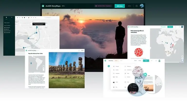
StoryMaps are simple web apps that combine interactive maps, multimedia content, and narrative text to create digital stories that are accessible by anyone with an internet connection.
This digital storytelling tool uses a single, flexible content builder where you can add maps, text, photos, audio, timelines and videos to create an interactive story that’s easy to publish and share. They work on a variety of screen sizes and are hosted on aweb-based platform in the cloud created by the StoryMapsTeam at Esri(Environmental Systems Research Institute), an international supplier of geographic information system (GIS) software, web GIS and geodatabase management applications. In 2019, Esri launched the new ArcGIS StoryMaps which is an updated platform of new features and capabilities, transitioning from the ‘Classic’ Esri Story Maps that have been around for nearly a decade.
The basic layout of a story in ArcGIS StoryMaps is a scrolling narrative; just like a waterfall (that’s why it was previously called ‘cascade’ in the classic maps). You can stack text and media content to create a story and even add a credits section at the end of the story for all your citations and references. A block is any component you use to build a story, whether it be a paragraph of text, an image, or a map. The block palette brings together all the blocks into a combined menu that can be added to a story in just one click.
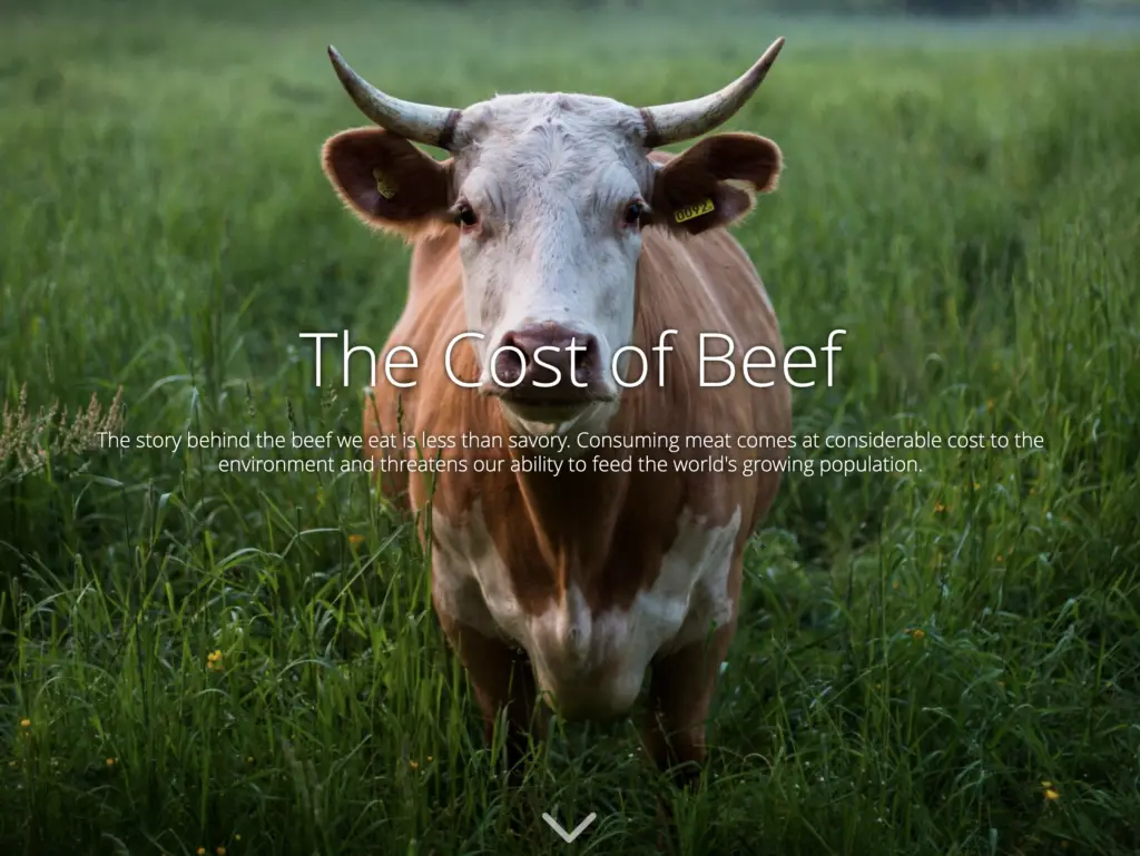
(Farm) Animal Planet is a great example of an eye-catching cover page and tells a story of livestock production on the planet. It shows how easy it is to scroll through the text, images and interactive maps to engage in a story about livestock around the world.
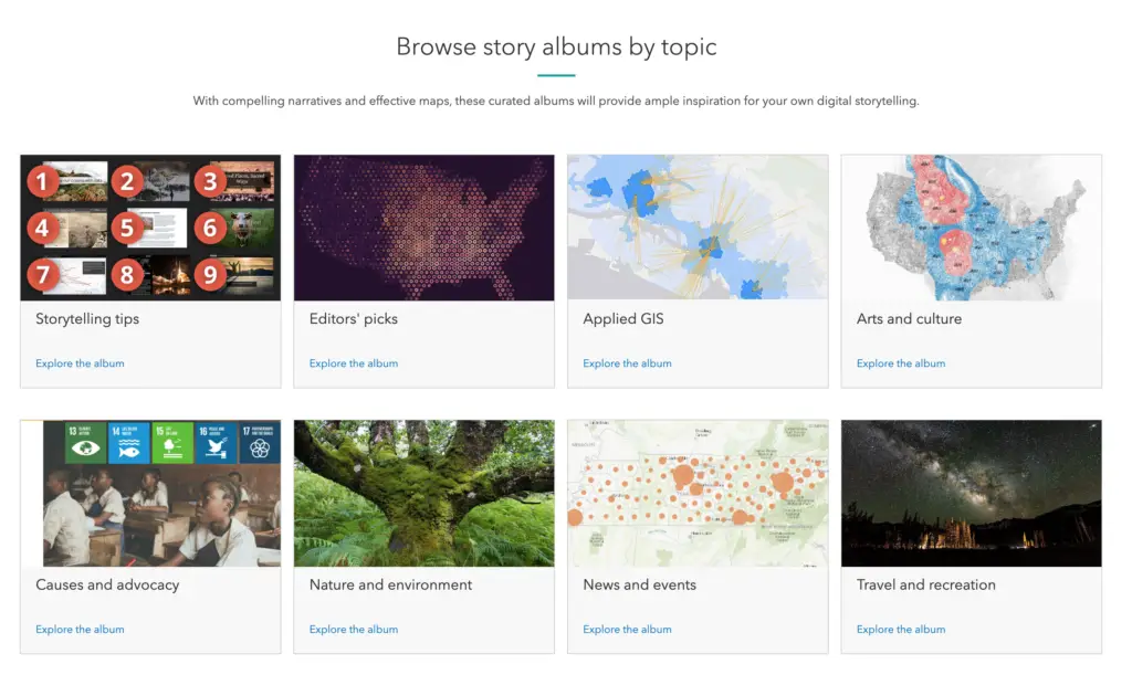
A great place to start looking…Esri StoryMaps Gallery
The best way for you to be introduced to a StoryMap is to get involved in the story, so start here by browsing through the ArcGIS StoryMaps Gallery.
StoryMaps have made place-based storytelling accessible to everyone. You no longer have to be a cartographer or web developer to create a StoryMap as they link to information via the Internet and are constantly updated and improved by the Esri StoryMaps team.
In short, they are fast loading, easy sharing, and aesthetically pleasing. They are also easy to design and easy to create; and one of the best features I like in the updated ArcGIS StoryMaps is that you can always change your mind about the layout of your story.
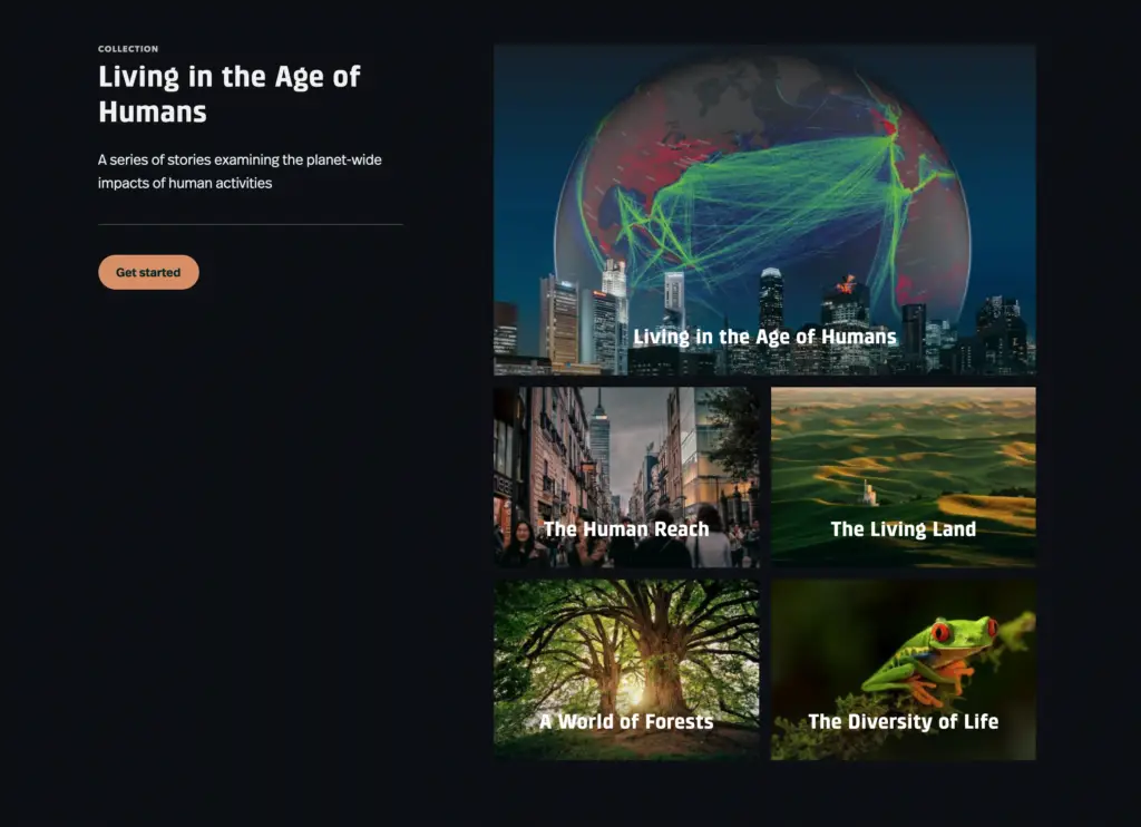
One of the most popular uses of a StoryMap is for education butThe Myriad Uses of StoryMapsshows other ways in which you can use a StoryMap for public engagement, activism, presentations, personal narratives, online guides and atlases, catalogues, crowdsourcing, portfolios, projects, tutorials and resumes.
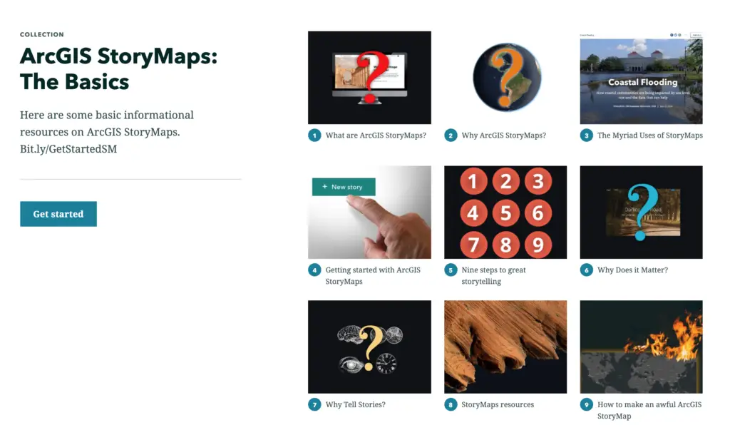
After you have found a range of StoryMaps that you like, you can start creating your own, and become familiar with the language of its design features and the range of content builder options available for your storytelling. Before you start creating your own StoryMap click here for The Basics of ArcGIS StoryMaps, a collection of 9 stories accessible by just having one URL address.
Why use StoryMaps in the classroom?
There is definitely a buzz around ArcGIS StoryMaps in classrooms at the moment, and even though this visually appealing storytelling platform has been around for nearly a decade, it has now become more popular than ever to show off your design skills in an easy to use web-based platform. She Maps are now incorporating StoryMaps to create unique Geography and STEM units of work mapped to the Australian curriculum. They are flexible, dynamic and easy to update; which can be image-based or map-based, or a combination of both.
According to Esri, a third of ArcGIS StoryMaps users are from the education community. StoryMaps are being used for teaching content and engaging students with a variety of stimulus material on a certain topic. There is also the opportunity for students to showcase their creative skills by creating their own StoryMaps to demonstrate their understanding and knowledge of spatial skills. Students can also communicate their research findings, field trip results or display their map skills by embedding maps they have already created in ArcGIS online. They can use them to work independently through activities at their own pace or use the many existing StoryMaps already available to guide their learning.
Some teachers are now replacing Powerpoints with StoryMaps as a presentation tool, as students can explore and engage with the interactive content all in one place, especially with a new generation of students that are very adept at using digital devices. They have a place in all subject areas in the curriculum and the topics are endless.
Learning via visual storytelling
As a visual learner, images and maps make it much easier for me to retain information, so using StoryMaps to introduce a specific topic or concept is a great way for teachers to connect with their students, especially with a cover image that grabs their attention.
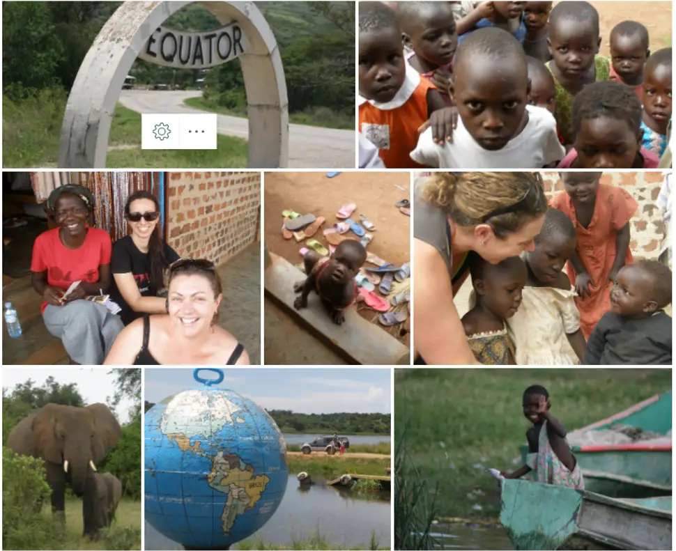
We all know that a ‘picture can be worth a thousand words’, so the image gallery feature is particularly useful for Humanities and English where you can guide students’ analysis of visual media to encourage critical thinking skills. Image galleries in StoryMaps can allow you to combine up to 12 images at a time. By prompting students to slow down their thinking and simply observe before asking questions, you can help them engage with, and analyse more thoughtfully the media they are viewing.
Example of an image gallery of photos in StoryMaps that can be used to ‘see, think and wonder’
Displaying a range of multimedia content through a StoryMap is not only easier but more environmentally friendly than making multiple copies for students. It has also become extremely popular for practicing assessment pieces that involve stimulus materials such as photographs, political cartoons, propaganda posters, paintings, video clips, or any other piece of visual media that lends itself to deep analysis by students.
Easy to use and explore
As StoryMaps can be displayed on a PC, tablet or smartphone, students and teachers aren’t wasting time loading media. To start, all you need is a URL address because ArcGIS hosts all of them in the cloud and they open up in a new tab. Once you open your StoryMap, just scroll down or use the navigation panel like chapters in a book.
Another advantage of StoryMaps is that it lends itself to online learning, which in recent times has become all too familiar. Students can work through StoryMaps in class or at home at their own pace online. It’s also a great way for teachers to flip the classroom, as the scrolling sequence of StoryMaps makes it easy to navigate.
Teachers can also create their own design themes to build a familiar format for students to follow with lesson outcomes, activities, homework, or even practice exam questions intertwined with stimulus material on a particular topic.
Easy to create digital stories
There is no need for coding skills as the content has been built for you and the tools used to create StoryMaps are rapidly evolving and becoming easier to use. It is easy to embed websites and video, or add maps that have already been created in ArcGIS online or import data from other ArcGIS apps such as Survey123.
You can become a storyteller by choosing your content and building an interactive narrative that’s easy to publish and share. You can create a new story from scratch and then choose to add immersive blockssuch as Slideshow, Sidecar and Map Tour depending on your purpose and audience.
Choosing Between Sidecar and Slideshow in ArcGIS StoryMaps – What this video
Map Tour now has 2 options to choose from: Guided and Explorer. Explorer tour is great if you want to feature a lot of locations on a map; with grid, list or media-focused layouts to choose from.
Teachers can use the design panel to tie their story together so it makes sense for students, and students in turn can start creating short StoryMaps as they build their confidence with the content builders. It’s also a good idea to model planning with a Word document first, so that all text and multimedia links are ready to be pasted into the StoryMap. Text can be formatted easily and you can play around with design options with the click of a button.
It also encourages students to use their creativity by deciding on the style that is best suited to what they are presenting. Another big bonus is that they autosave and you can stay in draft mode until you’re ready to publish and then you still have an option to edit published stories without affecting the version that everyone can already see online.
Interactive maps seem essential now, given the fact that our students have grown up using Google Maps and Google Earth, but maps can play many different roles in a StoryMap. They can be static and just used for geographic location, or be fully interactive in 2D or 3D, receive real-time data feeds (dashboards) or be combined with surveys and other GIS elements. It depends on what you want to convey to your audience, but with so many map features available, it would be hard not to use some sort of map in a StoryMap! (says the geography teacher)
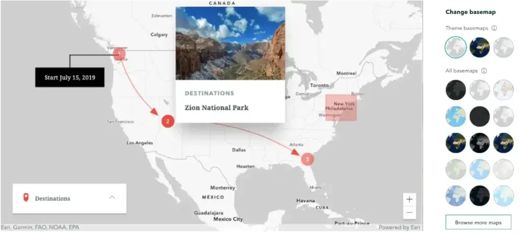
If you haven’t mastered how to create your own maps in ArcGIS Online yet, there is now a new option to make quick and simple maps usingthe StoryMaps express map, without leaving the story builder. It allows you to add basic information and annotation to a map in minutes. You even have a variety of basemaps to choose from. Express maps allow simple mapmaking while still being able to embed web maps and web scenes, or choose from the collection of ready-to-use maps from ArcGIS Living Atlas of the World.
Example of an Express Map and Basemaps content builder
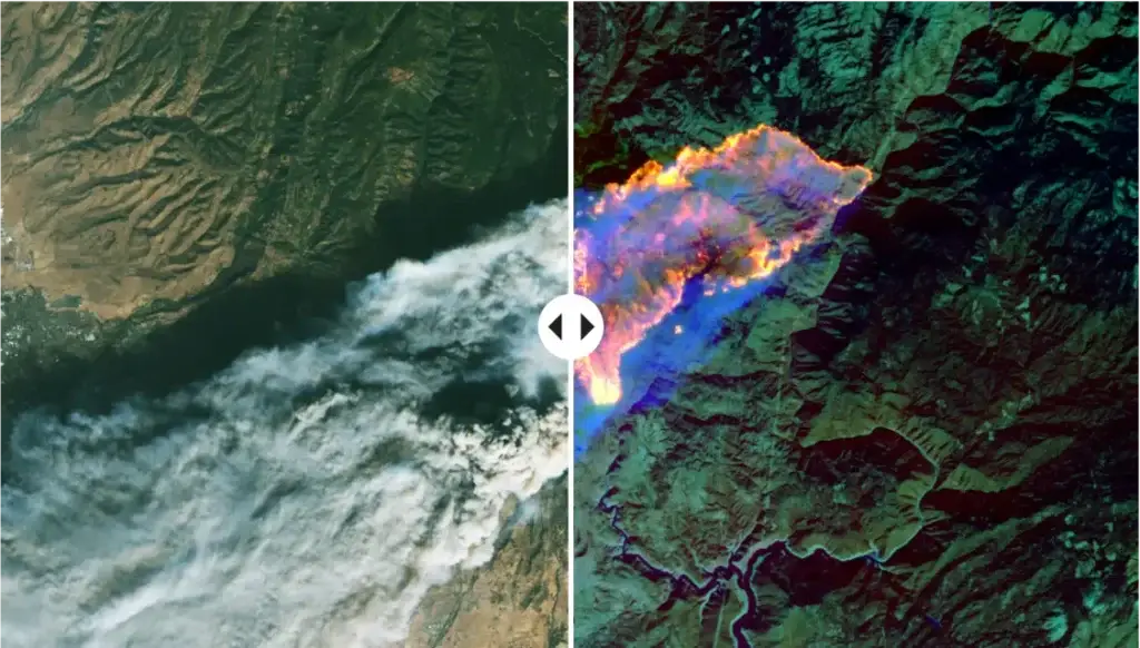
Swipe maps are another great map option that can directly compare two synchronized images or web maps simultaneously, using an interactive, handle with arrows that move right and left.
Swipe map of California Camp Fire 2018: natural colour image on left and false-colour infrared image on right from Landsat 8 from Dealing with Disasters
Visual comparisons are one of the most effective tools to foster critical thinking and work best when the image either reveals information about a particular time and place in history or reflects a particular perspective.The swipe media block in StoryMaps is a perfect example of this teaching strategy as it allows you to explore two images or maps from a temporal and spatial perspective.
A good example of swipe maps in action is Dealing with Disasters (above) which uses Landsat 8 imagery of volcanoes, floods and fires from NASA Earth Observatory to compare landscapes affected by disasters.
The Grace and Delight StoryMap also uses swipe maps to followthe evolution of public spaces in four American cities to compare paper maps from the nineteenth century to present day satellite imagery of each city.
Have a look at this collection of 6 Story Maps from Allen Carroll inMaps, Minds, and Stories to learn more about the meaning of maps, place-based storytelling and how our spatial minds work.
Teaching with StoryMaps
Instructional StoryMaps are becoming more popular with teachers as all they need to give their students is a URL to access the Story Map, and if you are using a Learning Management Platform at your school such as Blackboard or Canvas you just need to embed the link.
They are great tools to teach subject content, and lend themselves to all subjects especially Humanities and the Sciences, and of course Geography, where you can identify patterns, examine interrelationships, or describe trends.
A navigation panel under the cover page can be added to a StoryMap to link to sections in your story like chapters in a book so students can choose to go back to specific sections of the StoryMap if they want to review any subject matter or jump to specific content for a lesson. It is also very easy to insert questions or activities for students within the story for assessment purposes. Students don’t have to even leave the StoryMap as content can be built into the one story using embedded websites or videos.
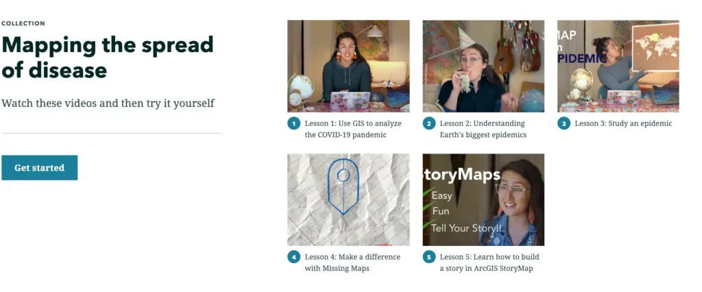
This is a great example of an Instructional collection of 5 StoryMaps about epidemics. Check out Mapping the spread of disease
More about Esri Australia
As most of the StoryMaps mentioned in this blog have been created by the American Esri StoryMaps team, here are some Australian examples of history orientated lessons created by Esri Australia’s Education Program Manager Jakeb Lovejoy that are definitely worth a look…
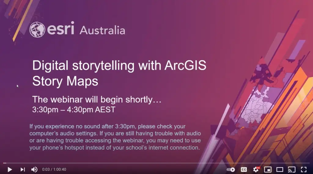
Watch this video from Esri Australia’s Education Program Manager, Jakeb Lovejoy, as he takes you through how to use Story Maps to deliver content in the classroom and here is the link to his ArcGIS Story Map that he uses in the video. Digital storytelling with ArcGIS Story Maps
She Maps Programs with StoryMaps
Check out two She Maps teaching resources that we’ve created with StoryMap. Each StoryMap includes interactive maps, narrative text, images, and multimedia content, everything you need to teach an engaging lesson.
She Maps is Australia’s leading expert in drone and geospatial education.
She Maps assist schools with the purchasing of drones, school-industry created drone and geospatial teaching resources and highly supportive teacher professional development.
FREE eBook – How to start a drone program at your school – Teachers Guide – Download Now
Learning Solutions Guide – Programs, Products and Pricing Guide – Read now
Ready to buy drones for your school? Browse our convenient classroom kits!
You’re in Safe Hands!
She Maps is a CASA approved commercial operator to fly microdrones indoors with students and teachers. CASA holds commercial operators, to a higher standard than recreational users and educators. This means that She Maps has been assessed by CASA as having rigorous training and risk mitigation procedures in place.
Want some help?
Schedule a call with one of our team members to get some personalised recommendations.
Take our resources for a spin and join the thousands of teachers who love our ready-to-teach classroom materials. Try one of our complete units of work for free.