Drones in Floods: How drones are a valuable resource for the problem
Guest Author
02 Sep 2021
Drones in Floods; This transdisciplinary teacher resource uses ArcGIS StoryMaps to demonstrate how GIS and drones helped with the problem in 2019.
This new unit of work is the second in a series of disaster themed units centred around geospatial tools such as drones and GIS (Geographical Information Systems) and the exploration of how they are a vital tool in assisting emergency responders.
It will focus on the responses from geospatial scientists to improve rescue and recovery missions and how they are using new technologies to eliminate or minimise harm to people and the environment, and be better prepared for natural disasters in the future. It also explores disaster resilience by looking at community awareness through education.
Disaster resilience education is an important element to the curriculum as it not only teaches students about how natural disasters are impacting communities around the globe but how it affects them at a regional and local level. With the frequency of bushfires, cyclones and floods in Australia it is not only important to enable students to participate in understanding the risks of natural hazards such as floods, but expose them to important STEM careers available to them in the areas of emergency responders, and GIS analysts and planners.
Transdisciplinary Real-world applications
Drones, GIS and Floods is a comprehensive case study unit that is flexible enough to be used for just one lesson or as a full unit of work. Each of the 5 lessons challenges students to use their Geography Inquiry Skills to explore the subject matter. There are also STEM challenges linked to lessons where students can use their design and technology skills as they use microdrones to become an SES drone pilot for the day by designing payloads to drop medication, lifejackets or radios and water to stranded people in floodwaters.
Drones in Floods, Case study approach: the 2019 Townsville
Queensland is no stranger to natural disasters such as cyclones, floods and bushfires, but climate change is now impacting on the intensity and frequency of these natural hazards.
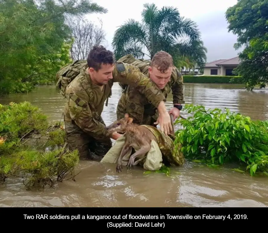
In early 2019 a major flood event occurred in the city of Townsville and surrounding areas, on the eastern coast of Queensland, Australia. A year’s worth of rainfall saturated Townsville in a week, causing the spillway gates of the Ross River Dam to be fully opened, inundating suburbs downstream. This inquiry follows a case study approach to this flood event, to investigate the causes and impacts of one of the most common and costly hazards in Australia.
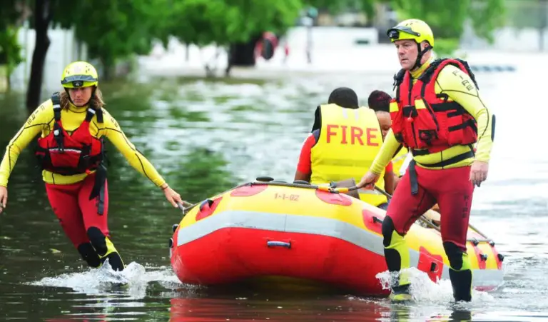
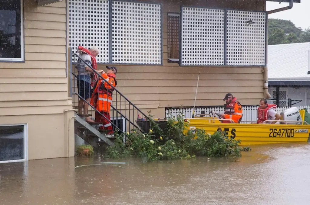
SES volunteers rescuing isolated residents during the 2019 Townsville floods Photo: QFES
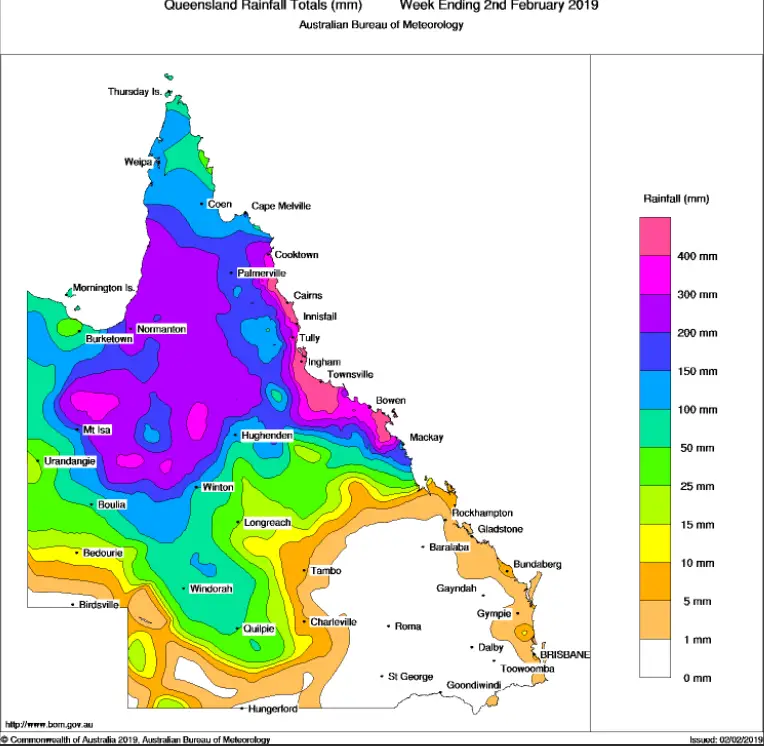
Rainfall totals for the week ending 2nd February. Source: BoM
StoryMaps: a new visual storytelling tool
This unit of work is presented in the new format of ArcGIS StoryMaps, a different style of presentation that we are now using at She Maps to provide stimulus materials for lessons that combine interactive maps with multimedia content and narrative text.
StoryMaps has been used in Drones to the Rescue to create a free-flowing series of content, together with accompanying lessons and activities in a PDF booklet. It can be used as a teacher-led resource or you can flip the classroom and allow your students to work through independent learning at their own pace. It is also useful for online learning at home as students only need the link to the StoryMap to access the unit. All the resources, instructions, and applications are found within the PDF booklet.
Take a look at the Instructional video for Flood StoryMap for a glimpse of this unique resource. Each lesson is matched to a navigation panel below the StoryMap cover page. All you need to do is click on the different headings in the panel like chapters in a book. This makes it very accessible if you want to go back and find information to answer activities or you can explore the case study just by scrolling down through the content lessons one-by-one.
StoryMaps also has some great design features such as interactive maps like swipe maps and immersive blocks such as map tours and slideshows. It allows you to zoom in to your study area and explore the map in detail.
StoryMaps are becoming increasingly popular for use in the classroom instead of Powerpoints as they work on a variety of screen sizes: PC’s, tablets and mobile devices are hosted by ESRI in the cloud which means they can be accessed by students with whatever device they have. All you need to view them is a URL link.
Real-world STEM role models: Drones to the Rescue
How are drones used in flood response?
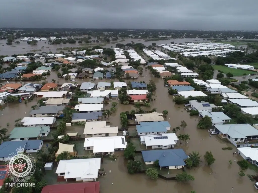
Drone image of flooded Townsville suburbs: Joanne Thomson QFES
Drones are increasingly being used in response to natural disasters such as floods, bushfire, tsunamis, and earthquakes. One of the best examples of the value a drone can offer is during a flood
A special feature of this unit incorporates a real-world story from a She Maps partnership with drone pilot Joanne Thomson from Queensland Fire and Emergency Service in Cairns. She shares her experiences in Townsville when she was asked to assist with intelligence gathering, situational awareness and recovery operations with her drone. As the Townsville Airspace is controlled by the Australian Defence Forces, she was able to get permission to fly when their rescue helicopters were also in the air. She could gather important images, allowing them to focus on rescuing people isolated in floodwaters.
Drones are a simple and affordable way to see events unfolding in real-time. This is particularly advantageous for emergency responders such as Jo, who are now using drones to capture photos and video footage to pass onto government agencies who don’t have enough time or budget to collect and process traditional imagery sources such as satellite data. In this way, drones are making critical real-time data accessible and shareable with the people who work to keep our communities safe.
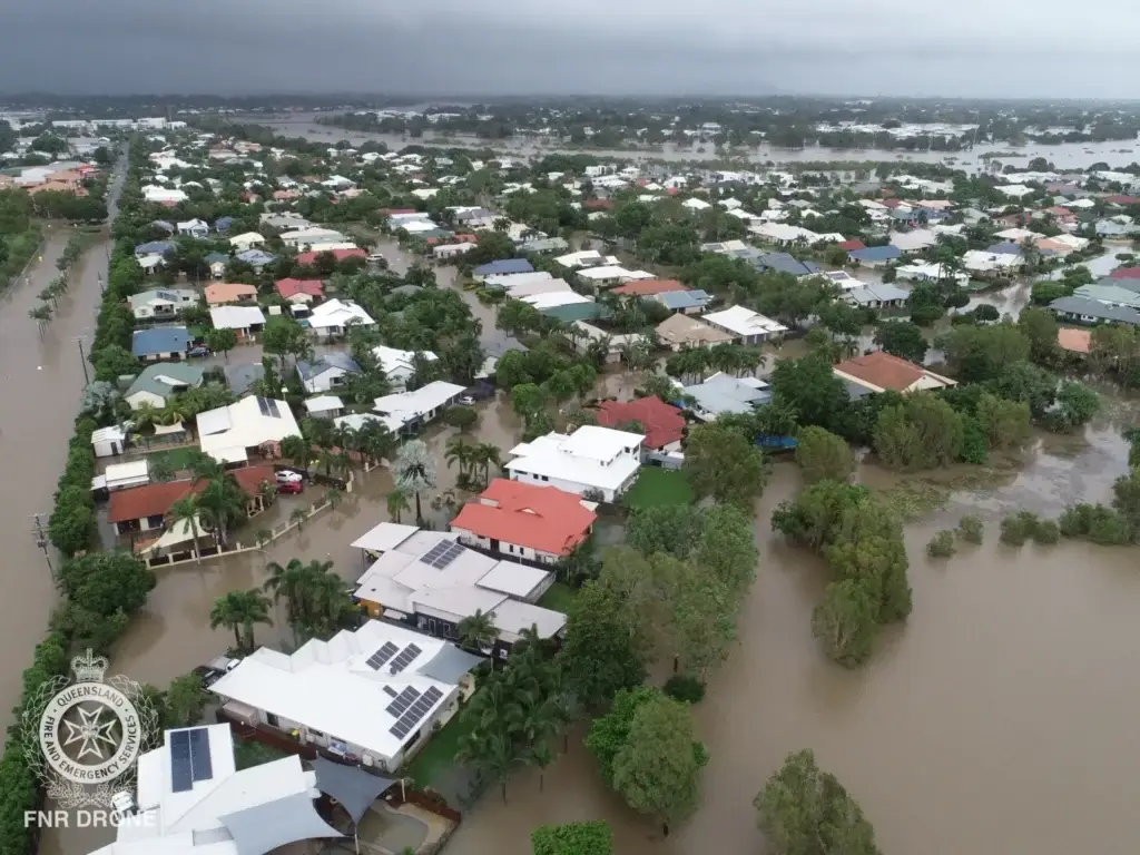
Drone image of flooded Townsville suburbs supplied by Joanne Thomson QFES
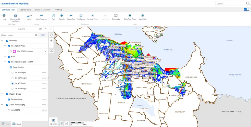
Using a GIS: disaster mapping
Drones and GIS are a team. These technologies work together to provide valuable real-time information for emergency responders. Drone footage, aerial photos and satellite imagery all come together in a GIS to analyse and predict events, but as drone technology advances it has become a vital component of disaster management.
In Lesson 4 of this unit of work: Using a GIS, students can discover how GIS is used for emergency response and interactive maps within the StoryMap enable us to see it’s capabilities.
The Australian Curriculum mandates the exposure to, and use of GIS technology in the classroom, so the earlier the exposure to its capabilities, the better. It comes under the Geographical Inquiry and Skills Strand and although Australian states have different syllabuses, GIS features prominently across them. In regards to the Queensland Senior Geography syllabus it is now mandatory for students to be using spatial technologies for assessment, so the younger they start the better.
GIS is used in almost every industry and is an engaging way for students to not only explore maps, but to interpret and analyse data and show their use of geospatial skills. This unit is most suitable for Junior Secondary but can be differentiated for Upper Primary classes and also used in Senior Secondary for case study practice. It is never too early for students to explore and use GIS to study the world around them and GIS is a tool that can be used across subject areas.
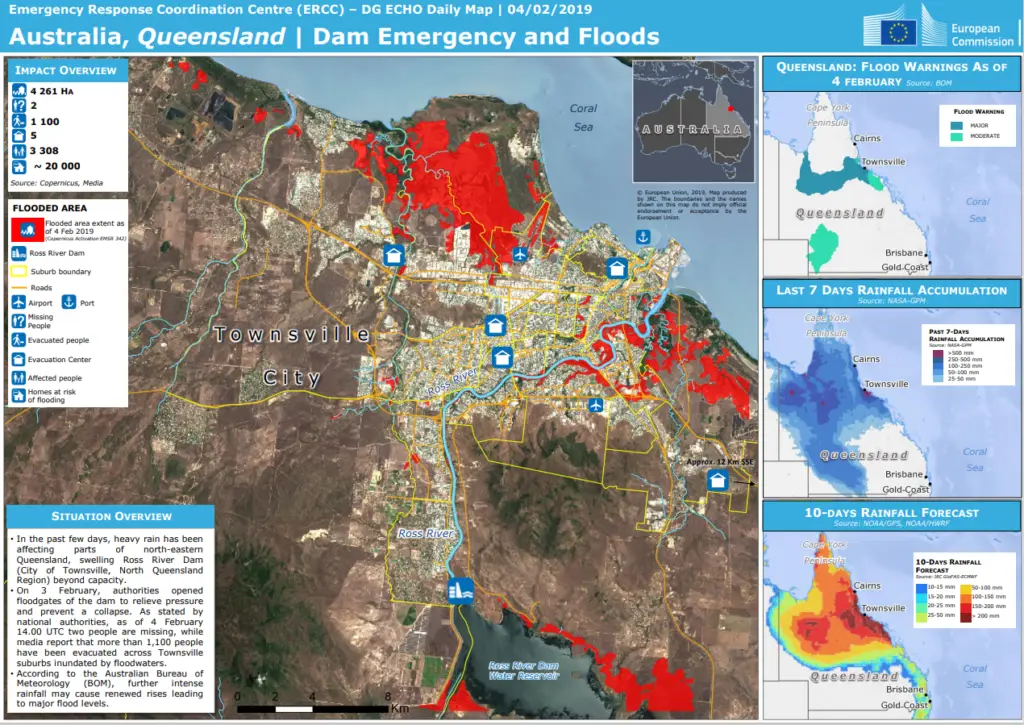
An example of how GIS can display important information about a flood emergency is shown below. Source EU Copernicus Mapping
An example of how GIS can display important information about a flood emergency. Source EU Copernicus Mapping
She Maps is Australia’s leading expert in drone and geospatial education.
She Maps assist schools with the purchasing of drones, school-industry created drone and geospatial teaching resources and highly supportive teacher professional development.
FREE eBook – How to start a drone program at your school – Teachers Guide – Download Now
Learning Solutions Guide – Programs, Products and Pricing Guide – Read now
Ready to buy drones for your school? Browse our convenient classroom kits!
You’re in Safe Hands!
She Maps is a CASA approved commercial operator to fly microdrones indoors with students and teachers. CASA holds commercial operators, to a higher standard than recreational users and educators. This means that She Maps has been assessed by CASA as having rigorous training and risk mitigation procedures in place.
Want some help?
Schedule a call with one of our team members to get some personalised recommendations.
Take our resources for a spin and join the thousands of teachers who love our ready-to-teach classroom materials. Try one of our complete units of work for free.