How Geography Teachers Can Revolutionise Learning with Technology
Katie Vidal
18 Apr 2025
Geography has always been about exploration—charting maps, understanding landscapes, and studying the forces that shape our world. But today’s geography classrooms are transforming, thanks to innovative tools like drones and geospatial technology. The talk and textbook are making way for interactive experiences that spark curiosity and prepare students for the dynamic careers of tomorrow.
The role of technology in modern geography education
Gone are the days when geography lessons were limited to memorising capitals and sketching maps. With advancements in technology, geography teachers can now immerse students in real-world scenarios, making learning more engaging and practical. Drones, GIS (Geographic Information Systems), and satellite imagery have become integral to teaching complex concepts such as spatial analysis, environmental monitoring, and urban planning.
Drones: The eyes in the sky
One of the most exciting tools in the modern geography teacher’s toolkit is the drone. These compact aerial devices allow students to view and analyze landscapes from a bird’s-eye perspective—something that would have been unimaginable decades ago. For example:
Drones can capture detailed footage of mountains, valleys, rivers, and coasts, providing firsthand insights into geological formations and erosion processes.
Urban Planning:
Students can study city layouts and traffic patterns by examining drone-captured videos, fostering discussions on sustainable development.
Environmental Studies:
Teachers can use drones to monitor local ecosystems, teaching students about biodiversity and conservation efforts.
Geospatial technology: Mapping the world
Geospatial technology, which includes tools like GIS and GPS, is transforming geography into a hands-on, data-driven subject. With GIS platforms, students can analyze spatial data to solve real-world problems, such as:
Disaster Management:
Simulating responses to natural disasters, like floods or wildfires, to learn about risk assessment and mitigation strategies.
Climate Change Studies:
Mapping temperature changes or deforestation trends to visualize the impact of human activity on the planet.
Cultural Geography:
Examining demographic shifts and cultural landscapes, encouraging critical thinking about global connections.
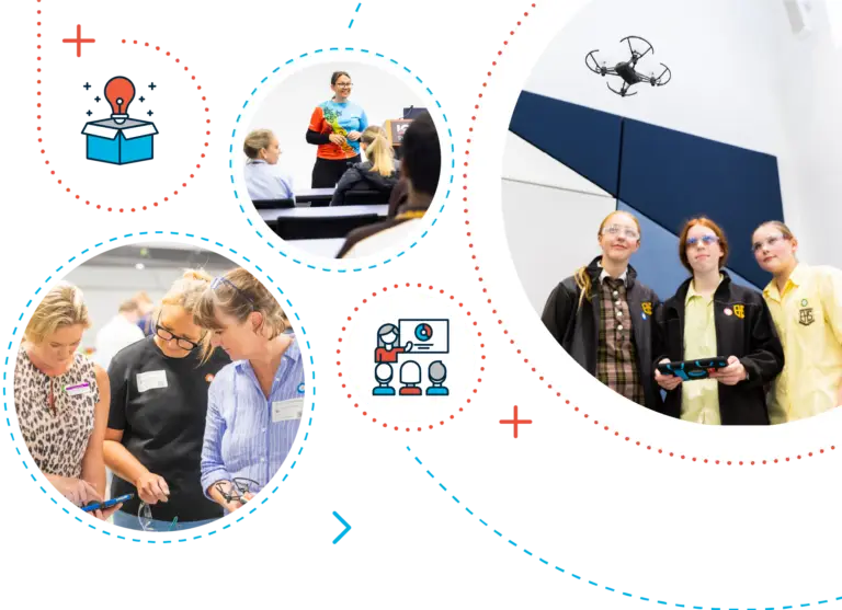
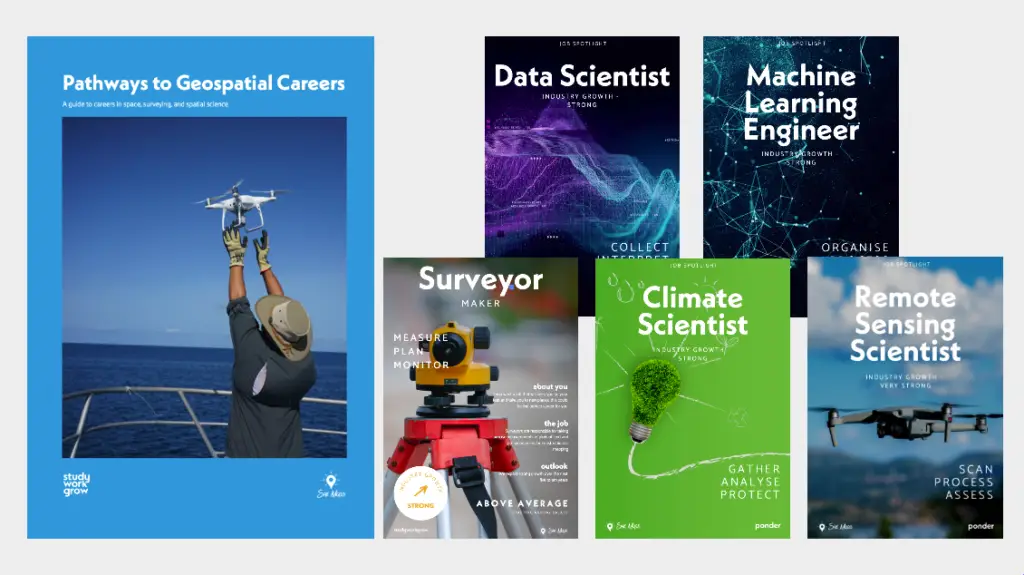
Geospatial careers guide and posters
Why this matters
Integrating drones and geospatial technology in geography lessons does more than make classes exciting—it equips students with skills for the future. Careers in urban planning, environmental science, and geospatial intelligence are on the rise, and these tools prepare students to think critically and creatively in these fields.
Moreover, these technologies nurture a deeper appreciation for the interconnectedness of our world. By seeing how global issues unfold in their own backyards, students develop empathy and a sense of responsibility for the planet.
Challenges and opportunities
Of course, incorporating technology into lessons isn’t without hurdles. Teachers need training to effectively use drones and GIS software, and schools must invest in the necessary infrastructure. However, the rewards far outweigh the challenges. Grant programs, partnerships with tech companies, and professional development opportunities can help overcome these barriers.
Find out more about education accounts
Reimagining the geography classroom
In the past, geography classrooms often lacked the allure of tech-heavy STEM subjects. But today, technology is giving geography a much-needed makeover. By blending traditional teaching methods with cutting-edge tools, geography teachers are fostering a generation of explorers, thinkers, and problem-solvers who can tackle global challenges with confidence.
Hands on drone teacher workshops
About She Maps.
She Maps is Australia’s leading expert in drone and geospatial education.
She Maps assist schools with the purchasing of drones, school-industry created drone and geospatial teaching resources and highly supportive teacher professional development.
FREE eBook – How to start a drone program at your school – Teachers Guide – Download Now
Learning Solutions Guide – Programs, Products and Pricing Guide – Read now
Ready to buy drones for your school? Browse our convenient classroom kits!
You’re in Safe Hands!
She Maps is a CASA approved commercial operator to fly microdrones indoors with students and teachers. CASA holds commercial operators, to a higher standard than recreational users and educators. This means that She Maps has been assessed by CASA as having rigorous training and risk mitigation procedures in place.
Want some help?
Schedule a call with one of our team members to get some personalised recommendations.
Take our resources for a spin and join the thousands of teachers who love our ready-to-teach classroom materials. Try one of our complete units of work for free.