Lighthouse Schools Program – Immersive Geospatial program for schools
She Maps Team
06 Jul 2021
Lighthouse Schools Program: Immersive Geo-STEM Education Program Launched in Queensland.
She Maps is proud to announce that our new Lighthouse Schools Program has launched!
We had an overwhelming response from Queensland Secondary schools earlier this year who applied to receive a fully funded place in our new Lighthouse Schools Program and we are now supporting 14 schools to lead the way in STEM!
The Lighthouse Schools Program is a unique education spatial immersion initiative funded byThe Surveyors’ Trust, where teachers are personally supported by our She Maps education team, to develop their capability in teaching critical STEM industry skills to their students.
She Maps is now on an exciting journey with a select group of Queensland Secondary Schools to co-design a STEM program that integrates drones and geospatial skills into their curriculum.
This is She Maps’ highest supported program, providing teachers with a tailored curriculum that extends student learning as they gain exposure to critical future STEM skills, and are given industry insights to tackle and solve real-world problems.
Our education team is now supporting 10 Lighthouse Schools, representing all 7 regional areas of Queensland. This personalised support involves a mix of professional development, face-to-face incursions, teacher resources, school visits and access to our industry partners and scientists. We have also chosen a further 4 schools deemed Pathway Schools that will also receive support from She Maps via virtual coaching and online professional learning to work towards becoming Lighthouse Schools in the future.
We have selected a combination of both public and private schools from across the state so that they can share their diverse STEM knowledge and form a community of professional practice.
The Surveyors’ Trust
She Maps is very grateful for their amazing partnership with The Surveyors’ Trust, which financially assists a range of She Maps Programs that help to bring drones, geospatial technology, and teacher resources into Queensland schools. Through their continued support we aim to increase teacher confidence and capability to teach STEM skills, and increase student connection to the surveying and spatial industry.
Deepen teacher capability and student achievement with STEM concepts and practices
Build a bridge between industry and education in a relevant and meaningful way
Translate modern STEM practice into the school curriculum and facilitate deeper understanding
Establish and maintain a productive and sustainable school-industry partnership
Help schools gain recognition and a reputation as an innovative STEM focused school
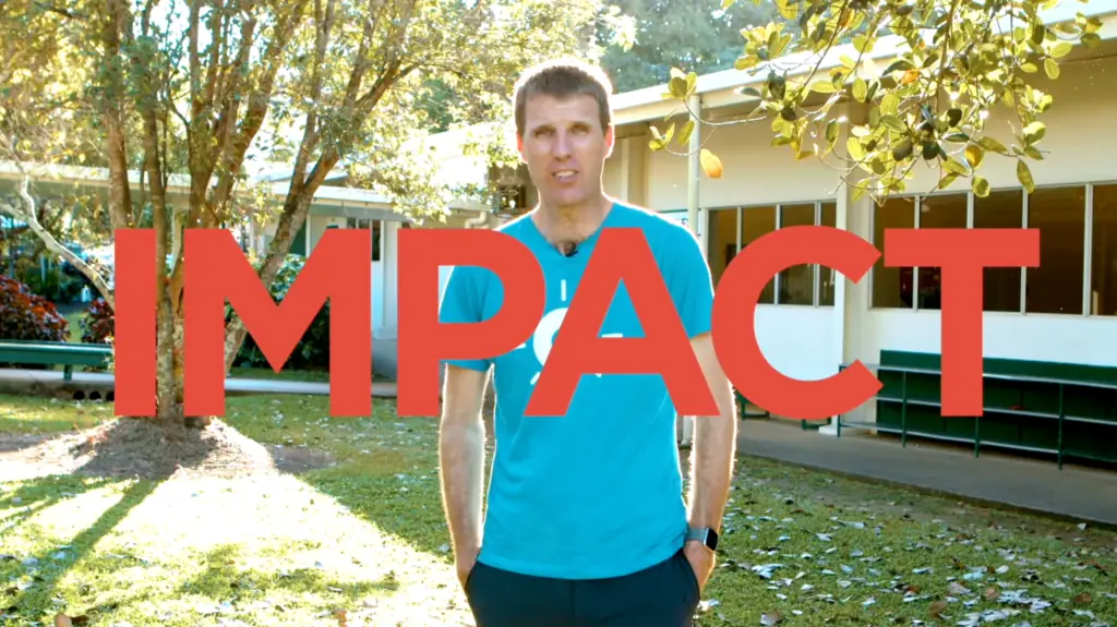
Our Impact - Aspirational Geo-STEM Lessons
Did you know that occupations such as surveyor, cartographer and spatial scientist are officially listed as Australian Skilled Migrationshortages?
Here at She Maps we know that geoscience is one of the most important emerging and evolving industries in the future workforce and we want to help teachers gain the confidence to use technology such as drones and GIS, so that their students are equipped with the geospatial skills to enter the workforce. Read more here about 5 Surprising Careers in STEM!
As a social enterprise, She Maps has a strong Theory of Change and if we want to have the impact to create change in the future of the STEM workforce then we need to help teachers. We believe that if we can increase the confidence of teachers to teach STEM and show their students a diversity of role models solving real-world problems, then this will create a more diverse student cohort, who are interested and capable in STEM subjects. Read more here about our impact in Our Cultural Heart booklet.
Our Outcomes - Building Geo-STEM Confidence, Capability and Connection
We have categorised our Program’s outcomes into She Map’s 3 strategic actions of confidence, capabilityand connection.
As it is a co-designed approach with each school, together we will drive these outcomes with schools on an individual basis to create a tailored STEM plan based on each school’s curriculum needs and requirements.
For students, we want to ensure they finish school with a strong foundational knowledge of modern STEM applications to solve some of the world’s challenges.
For teachers, we want to boost their confidence, capabilities, and knowledge in the teaching of STEM, particularly in the use of drones, spatial tools, and other digital technologies.
For the whole school, we want to establish a positive school culture and reputation where the importance of STEM is recognised and valued, while building sustainable partnerships between other schools, tertiary education providers, and industry, providing opportunities for students into the future.
Teacher Professional Development
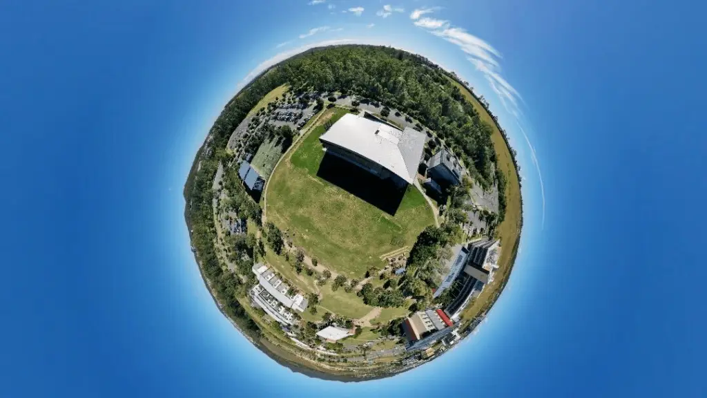
Photo: Dr Karen Joyce, Mavic 2 Pro, Springfield USC Campus
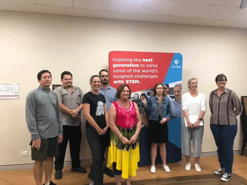
After finalising our schools during the Easter holidays, we embarked on hosting Professional Development Workshops in Cairns and Brisbane to not only bring our teachers together face-to-face, but to introduce our Lighthouse and Pathway School Teachers to the She Maps signature programs. We wanted all of our teachers to be onboard with our company’s values and theory of change so it was more than just about flying a microdrone!
Instructors included our Managing Director Paul Mead, our Education Director Dr Karen Joyce and our Lighthouse Schools Program Manager Angela Lapham. We were also supported in our workshops by Jakeb Lovejoy from ESRI Australia, Edward (Ted) Carter from EDwoodUCATION (a She Maps Education Partner) and data scientist Joan Li from GeoNadir (a She Maps sister company).
We taught two PD streams comprising our She Maps signature programs to cater for the differing learning needs of each Lighthouse School, and their individual teachers.
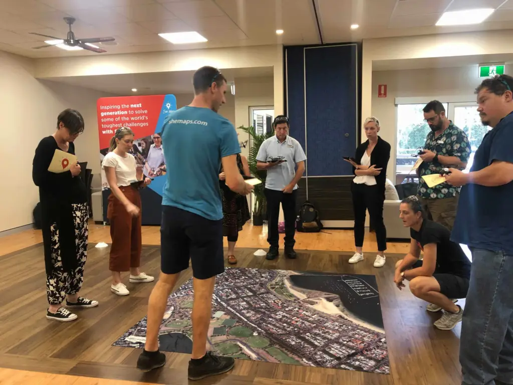
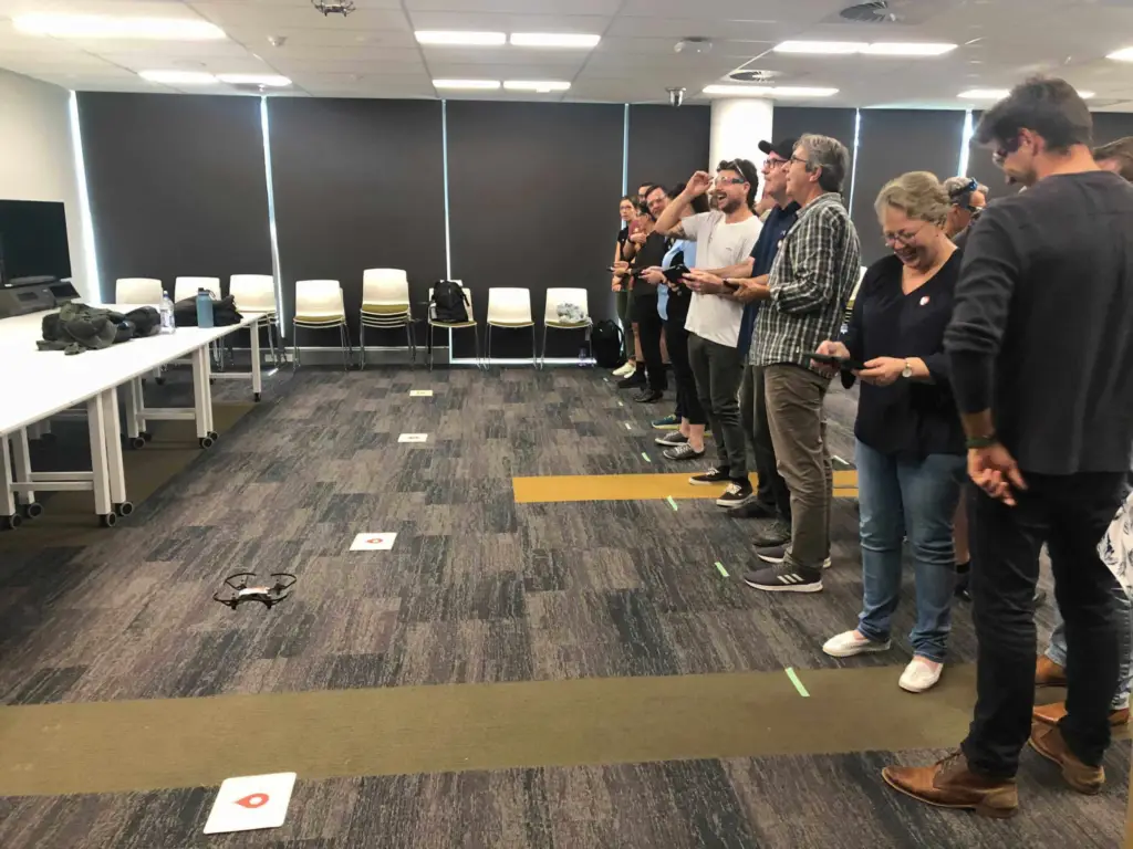
This series of workshops focussed on the use of microdrones (Tello), the use of basic geospatial tools in our Map My School Program and STEM units of work mapped to the curriculum.
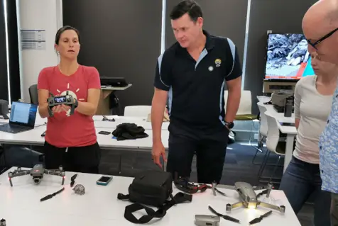
This series of workshops started with an introduction to microdrones (Tello), and then focussed on the use of sub 2kg drones to plan and conduct a mapping mission using ArcGIS tools.
One of our signature programs, Classroom Drone Essentials, was taught to all of our participating teachers on the first day, and provided them with a foundation to confidently teach microdrone lessons to their students. This 2.5-hour morning session allowed our teachers to become geospatial scientists for the day, be exposed to great STEM role models, challenge unconscious bias, explore applications of drone technology, understand safety and drone regulations, as well as learn how to fly and code drones. Watch this inspiring video that we showed to our teachers!
PD at Cairns Surf Life Saving Club, Palm Cove 17-18 May Teachers from Trinity Bay SHS, St Stephen’s Catholic College, Ingham SHS and Good Counsel College
Classroom Drone Essentials at Cairns Surf Life Saving Club, Palm Cove 17-18 May
Classroom Drone Essentials at University of Southern Queensland, Springfield Campus 20-21 May
Drone Mapping with Dr Karen Joyce at University of Southern Queensland, Springfield Campus 20-21 May
Identifying capability gaps in Geo-STEM education across the curriculum
We have already been receiving invaluable feedback from our teachers after our first PD workshops that are helping us identify capability gaps and where our support is most needed.
The geography teachers that attended have also told us that they especially want to connect with the science, maths and technologies teachers in their schools to implement geospatial skills across the curriculum. Our participating teachers want an integrated approach to STEM and Geography, especially when students’ future careers will almost certainly involve working with people from a range of disciplines to solve real-world issues. Teachers want their students to be exposed to the rapidly evolving drone industry by capturing important data from above that can be analysed with geospatial technology to present important solutions to challenges such as disaster response and environmental management. Drone and GIS (Geographical Information Systems) technology is constantly evolving, and educators want the confidence to teach these interdisciplinary skills in engaging ways.
With funding from The Surveyors’ Trust, She Maps offers support to our Lighthouse Schools through the following activities:
Confidence
Professional Development – online and face-to-face PD focussing on microdrones and geospatial programs, with access to more advanced opportunities such as Drone Blocks and Drone Mapping
Student Incursions – to increase teacher confidence with a ‘I do, we do, you do’ approach
Support Calls – to provide free advice on drone purchases and technical support
STEMinars – to provide free webinars to inspire thought-provoking discussion on classroom based issues and challenges
School Visits – individual site visits and teacher support calls, to develop a microdrone and geospatial program in schools
Capability
Resources – access to free and paid resources through She Maps ORBIT membership
Competitions – entry into our annual Map My School competition and Tournament of Drones to support student learning and upskilling
GIS for Schools – partnership with ESRI Australia to set up a free ArcGIS online account to access geospatial software
Units of Work – to provide extension units of work to enhance the curriculum that teachers are already delivering by providing real-world STEM scenarios and relevant case studies
Group Calls – to share resources and professional practice between schools
School Improvement Plan – to develop a curriculum-linked plan on how teachers want to achieve STEM outcomes in their school
GeoNadir – free access to the GeoNadir drone data management platform and advanced Drone Mapping support with Dr Karen Joyce
Connection
Group Calls – to connect with other schools online and create a network of support
Newsletter – to keep our schools informed about STEM successes and current pedagogy
Partnerships – to provide access to She Map’s network of tertiary education partners, industry and business professionals, and scientists
Careers – to help connect with the right providers of the RePL and Cert III in Aviation (Remote Pilot) training
EduDrone Conference – to build connections with other STEM educators and industry experts, with free registration to EduDrone 2021 in August for five teachers
OUR LIGHTHOUSE SCHOOLS 2021
Lighthouse Schools 2021
St Stephen’s Catholic College, Mareeba (Far North)
Trinity Bay State High School, Cairns (Far North)
Ingham State High School (North)
Heights College, Rockhampton (Central)
Wavell State High School, Brisbane (Metropolitan)
Sheldon College, Redlands (South East)
Ormiston College, Redlands (South East)
Toowoomba Anglican School (Darling Downs)
Sunshine Beach State High School (North Coast)
Hillcrest Christian College, Gold Coast (South East)
Pathway Schools 2021
Good Counsel College, Innisfail (Far North)
Bray Park State High School (North Coast)
Chancellor State College (North Coast)
Wynnum State High School (South East)
Stay tuned for updates on what our schools will be doing next STEMester!
About She Maps.
She Maps is Australia’s leading expert in drone and geospatial education.
She Maps assist schools with the purchasing of drones, school-industry created drone and geospatial teaching resources and highly supportive teacher professional development.
FREE eBook – How to start a drone program at your school – Teachers Guide – Download Now
Learning Solutions Guide – Programs, Products and Pricing Guide – Read now
Ready to buy drones for your school? Browse our convenient classroom kits!
You’re in Safe Hands!
She Maps is a CASA approved commercial operator to fly microdrones indoors with students and teachers. CASA holds commercial operators, to a higher standard than recreational users and educators. This means that She Maps has been assessed by CASA as having rigorous training and risk mitigation procedures in place.
Want some help?
Schedule a call with one of our team members to get some personalised recommendations.
Take our resources for a spin and join the thousands of teachers who love our ready-to-teach classroom materials. Try one of our complete units of work for free.