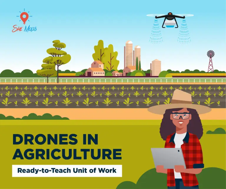
Drones in Agriculture – An integral part of a farmers toolkit
Katie Vidal
16 Nov 2022
Drones in Agriculture - Working on the farm with emerging technology
Drones and GIS are joining forces with tractors and other agricultural equipment as they are utilised by farmers, graziers and agricultural professionals for a number of jobs. From tree seeding to stock management, monitoring crops, infrastructure management and weed control the tasks that drones can complete on the land are increasing exponentially.
The global agricultural drone technology market is forecast to hit $8.4 billion AUD in 2028, up from $1.9 billion AUD in 2020 according to some reports.
Drones in Agriculture - Teachers pack
This unit can be taught across a term or a semester. The modules can be taught by one teacher, a pair or even a team. She Maps teaching resources are designed to change depending on the teaching environment and your students’ needs. We call it transdisciplinary and we want teachers to use our resources in a way that is comfortable for them.
Take a look at what it has to offer. The teaching and learning resources include:
Lesson Sequence
Interactive StoryMap
Student Activity Sheets
Curriculum Mapping
Assessment Rubrics
Fact Sheets
Display Sheets
Coding Instructions Sheet
The video below will take you on a tour of the resource
Year 5-6 Unit of Work
For Years 5-6 students Drones in Agriculture is a STEM Food and Fibre unit with Digital Technologies embedded throughout the modules. It provides unique opportunities for students to learn about drones in the agricultural sector and then design, plant and monitor a mobile vegetable garden using learning processes including the technologies design process, scientific inquiry and mathematical modelling.
Module 1 – Drones in Agriculture
Module 2 – Design and plant a mobile vegetable garden
Module 3 – Inquiry learning – measuring environmental factors to determine requirements for survival of plants
Module 4 – Design and implement a microdrone flight to simulate monitoring and precision spray of the vegetable garden
Setting, planning, coding and communicating the drone mission
Module 5. Design and create an interactive simulation of a drone planting seeds in a horticultural plot
In Years 7-8, Drones in Agriculture students continues with the STEM Food and Fibre unit with Digital Technologies embedded throughout, it includes sorting edible plants into categories using dichotomous keys. The unit also introduces pseudocode into their drone coding. Not only does it take a more detailed look at drones in agriculture but it also explores how drones should be safeguarded from cyberthreats.
Module 1 – Drones in Agriculture
Module 2 – Edible Plants
Module 3 – Design and grow a mobile vegetable garden
Module 4 – Design and implement a microdrone flight to simulate monitoring and precision spray of the vegetable garden
Setting, planning, coding and communicating the Drone Mission
The Year 9-10 Drones in Agriculture is a design and technologies unit with a focus on emerging technologies in Food and Fibre Production. Module 2 has been designed in such a way so that classes can either use the microdrone programs or if they have the appropriate knowledge and skills, can use sub 2kg drones to collect photographic data.
Module 1 – Drones in Agriculture
Module 2
Microdrone version: Design and grow a mobile edible garden
Sub 2kg drone version*: Design and grow an outdoor horticulture plot
Module 3
Microdrone version: Design and implement a microdrone flight to simulate monitoring of edible garden
Setting up the Drone Mission
Plan the drone mission
Code the Drone Mission
Communicate the Drone Mission
Sub 2kg drone version*: Design and implement a drone flight to survey the horticultural plot
*She Maps encourages teachers to use the microdrones with students first to develop their drone skills, before they begin using sub 2kg drones. If they have not been introduced to microdrones before then we suggest taking them through Classroom Drone Essentials. You can find this in your She Maps Membership
Check out our membership or login to get access to all resources
Colour coded lesson sequence
All modules are colour coded to identify learning areas, including Mathematics, Technologies, Science and the Arts. Strands and sub-strands, key ideas and concepts are all listed in their identified colours so teachers can quickly make the curriculum connections they need.
She Maps prides itself on not only connecting to Version 8.4 of the Australian Curriculum, but we have also included Version 9.0 so that we are prepared for the transition.
This unit has a module to simulate aerial survey with microdrones, but we have you covered if you haven’t taken that step toward drones in the classroom. There are other opportunities for students to implement 21st-century skills to discover just where Agriculture is headed in the future.
Drones in Agriculture - Interactive StoryMaps
Like many of our resources, there is a StoryMap to guide teacher and students through Module 1.
StoryMaps provides a visual learning platform that students and teachers can follow in a sequence or they can jump from one menu item to another. If you haven’t experienced a StoryMap before, take a look at the following video.
This particular StoryMap escorts students through their learning from an introduction to drones in Agriculture, to a knowledge-building activity in Science and Digital Systems. The design challenge asks your students to use their knowledge to create an agricultural drone solution to complete an identified task.
Drones in Agriculture - Curriculum connections
She Maps prides itself on its knowledge and understanding of curriculum and as mentioned before this document covers all relevant achievement standards for both V8.4 and V9.0.
The learning areas included are:
Technologies
Science
Mathematics
And a touch of Media Arts
The curriculum mapping document includes full details of content descriptions and acheivement standards. It is a comprehensive curriculum document.
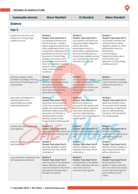
Easily accessible assessment
The assessment rubrics that are included in this unit link directly to the achievement standards. We want our teachers to be able to pick up our resources and use them easily, this includes an assessment rubric that links back to the curriculum mapping document for a strong connection across the resource.
Each rubric has assessable elements that cover all five modules, across all identified learning areas.
Engaging activities
Mobile Vegetable Garden
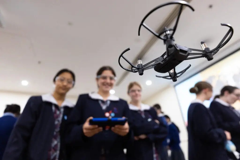
Get your students elbow-deep in learning by planning, designing and constructing their own vegetable garden that can be moved at a moment’s notice. Why? Well as crop growers they need to monitor their plants and what more inventive and exciting way to do it then with microdrones! They can simulate an aerial survey with a microdrone, indoors, with a vege patch on wheels! How cool is that? They plan, design and code a microdrone to fly over the top of their vege patch.
She Maps has made sure that this is flying for meaning. The key ideas and concepts that are covered include:
You may not be ready to get drones flying in your classroom and we’ve considered that.
Students have the opportunity to be in involved in an interactive simulation of a drone sowing seeds in a horticultural plot, they learn to use Scratch programming through a series of instructional lessons. So students can still be engaged in drone activities in the agricultural sector.
She Maps is Australia’s leading expert in drone and geospatial education.
She Maps assist schools with the purchasing of drones, school-industry created drone and geospatial teaching resources and highly supportive teacher professional development.
FREE eBook – How to start a drone program at your school – Teachers Guide – Download Now
Learning Solutions Guide – Programs, Products and Pricing Guide – Read now
Ready to buy drones for your school? Browse our convenient classroom kits!
You’re in Safe Hands!
She Maps is a CASA approved commercial operator to fly microdrones indoors with students and teachers. CASA holds commercial operators, to a higher standard than recreational users and educators. This means that She Maps has been assessed by CASA as having rigorous training and risk mitigation procedures in place.
Want some help?
Schedule a call with one of our team members to get some personalised recommendations.
Take our resources for a spin and join the thousands of teachers who love our ready-to-teach classroom materials. Try one of our complete units of work for free.